Snæfellsnes

Snæfellsjökull glacier
Jutting out from the western coast of Iceland, the Snæfellsnes peninsula is often described as ‘Iceland in Miniature’ due to the number of natural attractions and the hugely varied landscape. Boasting volcanic craters, lava fields, a glacier, waterfalls, fjords, hot springs, black beaches, golden sand beaches, lush meadows, and attractively colourful fishing villages dotted around the coast, it is one of the most visited regions in the country as it’s easy for tourists to get to from Reykjavík and, with all the above, gives people the opportunity to see something of what makes Iceland so special in a single day – a long day admittedly, but you can see most of it in a day.
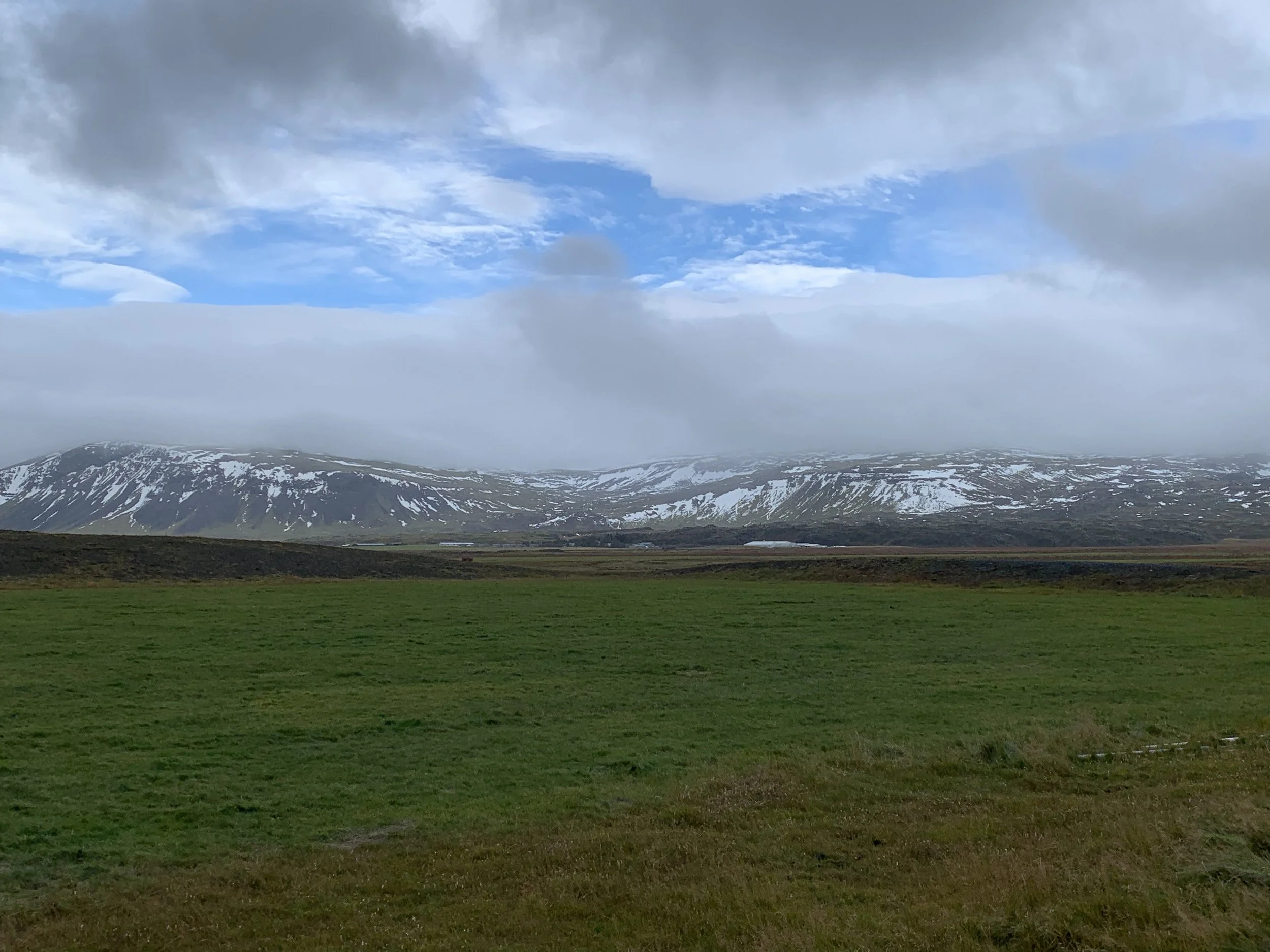
Meadows and mountains
Not surprising then that I’d been wanting to visit for some time and when we finally had the chance, we decided to make a weekend of it. This gave us time to see many of the things that make this region so famous – and actually spend some time at each, rather than having a whistle-stop tour with very little time at each place we stopped at. It takes about 3 hours to drive around the peninsula itself, not allowing for any stops at all, and not including the time it takes to get to the peninsula from Reykjavík, but with one overnight stop, we had the time to really begin to explore the region.
Ytri Tunga
Snæfellsnes is known for its ancient sea cliffs, glittering waterfalls and mountain gorges, its jagged coastlines, quaint meadows, and dramatic mountainscapes. And of course for the Snæfellsjökull glacier that has caused the region to be given National Park status. You can see the glacier for most of the time that you travel through the peninsula, looming in the distance as you drive through rolling farmlands, volcanic fields and tiny villages.

Stapafell
We had checked out some of the must-see attractions in the area beforehand so that we knew what to look out for; here are just a few of the places that I think are worth a visit:
Gerðuberg basalt cliffs

The hexagonal columns of the Gerðuberg cliffs
These incredible basalt columns are found just off Route 54 which is the main road around the coast of Snæfellsnes.
Like the cave entrance at the black beach of Reynisfjara on the South coast of Iceland, the Gerðuberg cliffs are made of towering hexagonal columns formed by ancient lava flows. Seen from a distance they just look like a solid wall, but as you drive closer the precise geometric symmetry is simply astonishing. You can walk along the base of the cliffs, or even along the top as we saw a couple of people doing, but it was such a windy day, I would never have dared to risk walking near the edge of the cliff – it was enough of a challenge staying upright as it was!

As it was such a cold and windy day and these cliffs are so exposed to the elements we didn’t stay outside long, but whatever the weather it is worth getting out of the car and walking to the base of the cliffs just to get a sense of the scale of these columns and the incredible symmetry of them.

Just as an added bonus, we noticed a tiny church a little way beyond the cliffs themselves and drove up to have a look. Set in the valley in the middle of nowhere, it appeared to belong to the house next to it, which looks as if it may be derelict – certainly uninhabited. It amazes me how these little churches are dotted around the Icelandic landscape, often in a little hamlet that doesn’t look as if it could provide a congregation each Sunday, but here, the only attendees would have to have come from the house next door!! I know many stately homes and manor houses in the UK had their own chapels, but here in Iceland it seems that even a modest farmhouse can have its own place of worship!


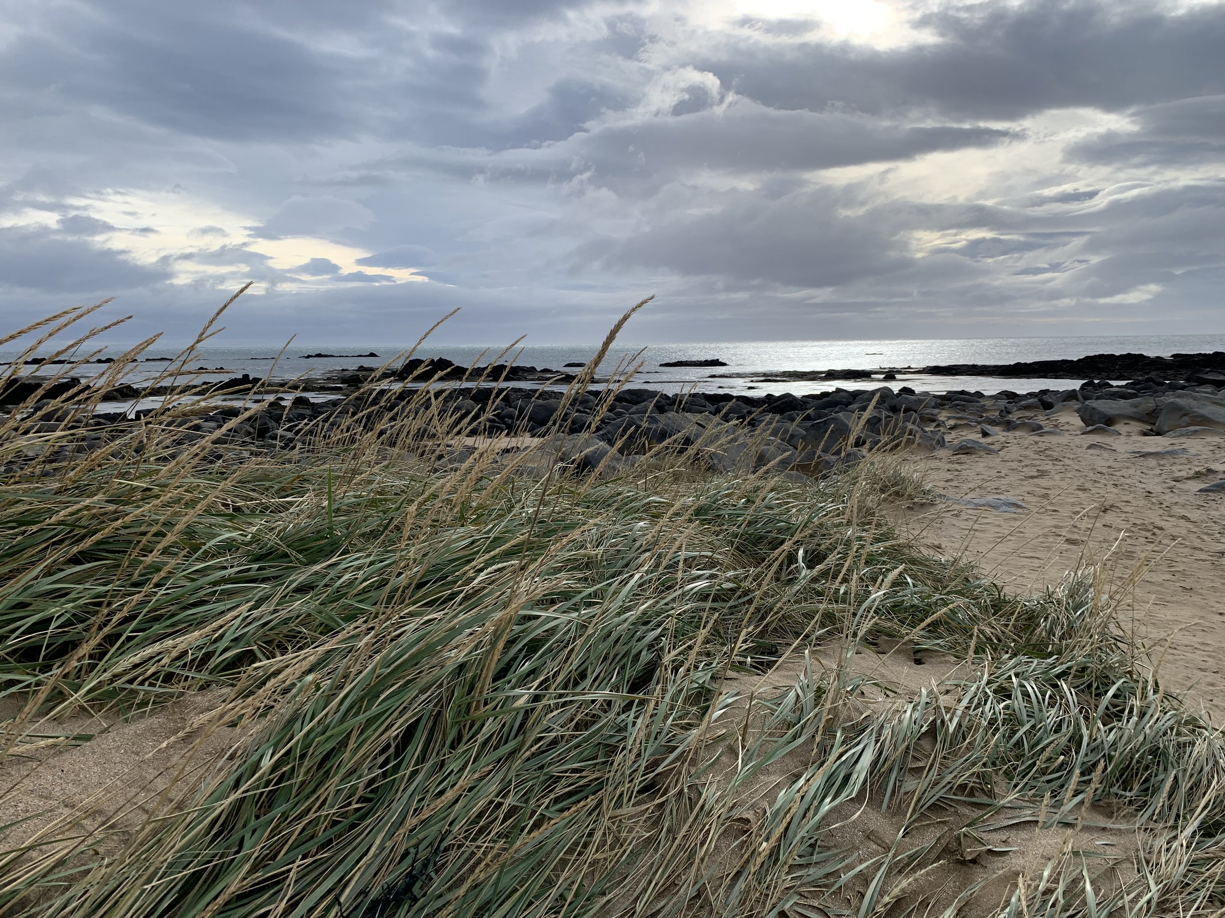
Ytri Tunga beach

The dunes at the edge of Ytri Tunga
Ytri Tunga is a beach on Snæfellsnes’ south coast which is known for its golden sand, which is relatively unusual in Iceland. But the main draw for visitors is undoubtedly the fact that Ytri Tunga is home to a seal colony.

Brooding skies add to the drama of the natural landscape
Summer is the main seal season, so we knew we may not see seals in October, but we decided to visit anyway on the off-chance. The sandy beach was a lovely place for a wander in any case. It is a gorgeous, scenic walk with views in all directions; whether gazing out to the ocean or back inland across the dunes with the volcanic mountains in the background. Although we weren’t prepared for the added sight of a whale carcass! At some point in the summer a whale had been beached and died here and we could see the bones strewn about the beach, as well as some of the huge carcass that hadn’t yet been eaten by the local wildlife.


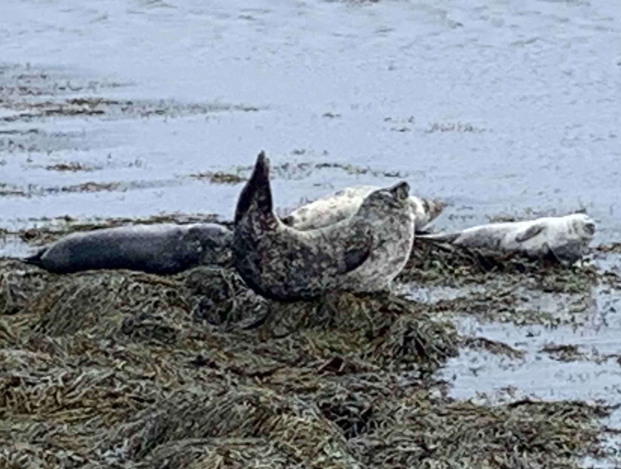
We didn’t need to worry about possibly not seeing seals – there were dozens of them! We could see them in the distance as we walked over the sand towards a group of rocks sticking out from the water. I have since found out that Ytri Tunga is one of the most reliable places in Iceland to see seals. Apparently at least a few individuals from the colony that lives here can be seen all the year round, with the summer obviously being the best time to see them in greater numbers.

The seals here are Harbour Seals and Grey Seals. Apparently, Seals and Icelanders have had an interesting relationship over the centuries. Seals, of course, were vital to the survival of the local people, due to their meaty bodies, fat for oil, and their waterproof hides, but they also appeared in folklore as mysterious and beautiful selkies. Most other Nordic countries depicted Selkies as evil, but not Iceland.

More recently, seals have been killed for fashion (and due to their impact on fisheries, as they often damage nets and equipment as they steal catches). Today, however, most Icelanders see seals as a beautiful addition to the culture of the nature rather than a pest or a pelt, and encourage visitors to enjoy viewing them.


In order to see the seals, we ended up having to wade across an area of shallow sea water from the main beach to a spit of land nearer the rocks. We knew not to go too close as we would have just scared them off, and the signs nearby ask visitors to be as quiet as possible so as not to scare them, but it meant we could get close enough to photograph them. I desperately wished I’d had a camera and tripod with a decent zoom lens, as it would have been possible to get some great shots, which wasn’t really possible with a phone camera, but it was an amazing sight as we watched the seals basking in what little sunshine there was. Well worth getting very wet feet for! I lost track of how long we spent watching these amazing creatures, but it was a very special time indeed.

Preparing to get wet feet again as we cross back to the main beach
Bjarnarfoss

The beautiful Bjarnarfoss
Bjarnarfoss is a relatively little-known waterfall that hadn’t even been on our list of places to visit, but we saw it from the car as we were driving past and decided to stop and take a look. Although it is possible to see it from the road it is worth parking in the car park that has been created near the falls and walking along the path to the bottom of the waterfall at least.

To go all the way up to the main waterfall you need to climb the relatively steep hill. It’s possible to climb up either side of the falls, but the slope is steep and articles about the waterfall warn travellers to take caution. This path to the waterfall is only accessible during summertime and should not be taken during late fall and winter. Given that the winds were high on the Saturday we were there it seemed a risk not worth taking, although we could see others making the climb. But even from the base of the waterfall it is very impressive and well worth the short walk from the car park. Another one to come back to in the summer and who knows, we may even make the climb up to the upper part of the falls on a calm summer day!

Búðakirkja black church
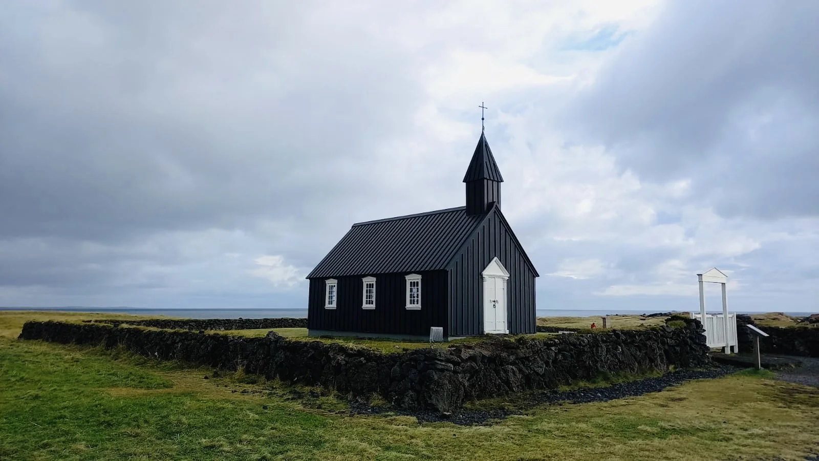
Búðarkirkja, the black wooden church near the sea
Búðir is a small hamlet in the Búðarhraun lava fields on the south coast of Snæfellsnes, and an important site in terms of the history of trade and industry in Iceland. The most notable building in this area is the old and stunning Búðarkirkja, the Búðir Church, which was built in 1848 and restored in 1987. This stunning black wooden church is a famous landmark and a very popular stop for photographers, as the landscape around it consists of sea, lava and mountains.
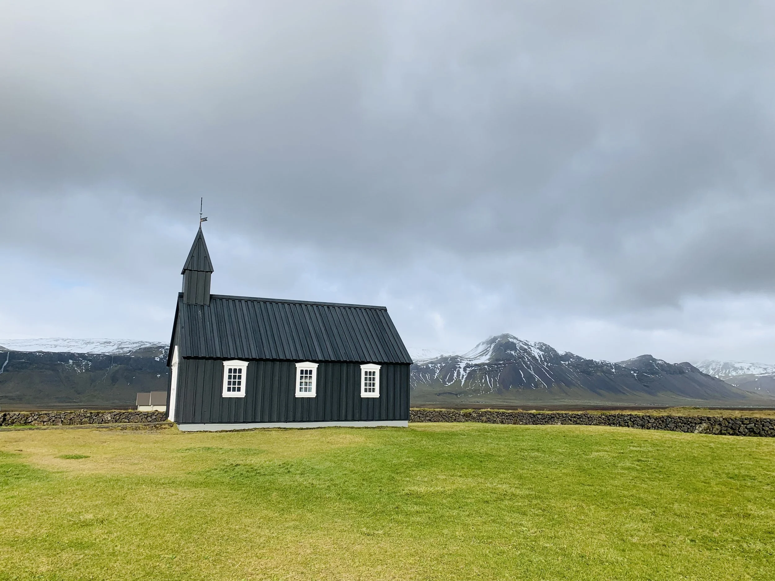
Stretching out around the building is an ancient lava field, potted with jagged black rock formations. Set in the heart of this otherworldly landscape, the church looks like something from a fairy tale. Apparently, in the summer it is almost impossible to get a picture of it without dozens of tourists crowding around, but due to the time of year and the weather we had it almost to ourselves.

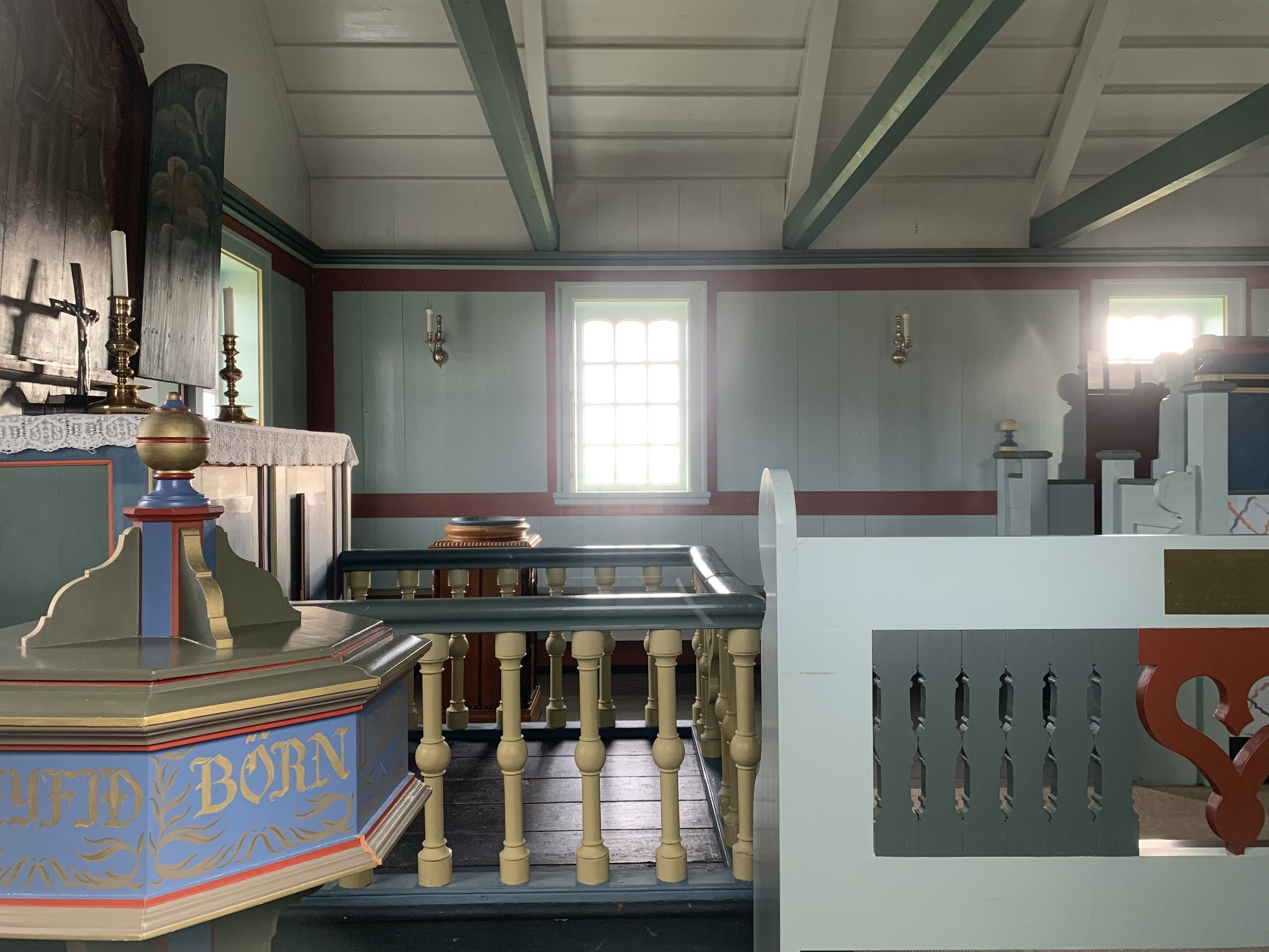
The church was locked, as is generally the case here outside service times, and we spent some time looking through the windows at the beautifully painted pews and simple interior. However, by a stroke of luck, as we were in the churchyard we saw a couple park their car and open the door as they carried chairs into the church. We took our chance and asked the lady if we may be able to come in for a few moments to pray. I think had we just been tourists wanting to explore and take photographs, the answer may have been no, but she gave us permission and we were able to spend a short time in the church itself.

The pretty painted interior of Búðarkirkja
Despite (or maybe because of) the rustic simplicity of its interior, the Búðarkirkja has an incredible sense of serenity and peace. The time spent in there was undoubtedly one of the highlights of my weekend and even though we were only a short time inside it was enough so that when we left, it was as if we’d been able to leave all the cares and pressures of life behind us. By a happy and extraordinary coincidence, Matthew had recently done a favour for a friend and been paid back in cash rather than into his account so, despite the fact that we have carried no cash since being in Iceland, we had money on us which he was able to give as a contribution to the upkeep of the church.

We got chatting to the lady who had let us in and it turns out she is retained to look after Búðarkirkja so she was able to tell us about it. There are very few services held there now, almost all of them weddings, as it has become a sought-after wedding venue due to the stunning location. Sadly, very few of them are local weddings, being much more likely to be tourists looking for a different and unusual place to be married, although the upside is that this does enable the church to be financially viable and therefore to remain open. It was an unexpected privilege and pleasure to be able to spend time in that beautiful place. A very special morning indeed.
Arnarstapi

Some of the buildings of Arnarstapi with Stapafell In the background
Arnarstapi used to be an important trading port at the beginning of the 18th century. It was then a large community according to Icelandic standards, with around 150 inhabitants.

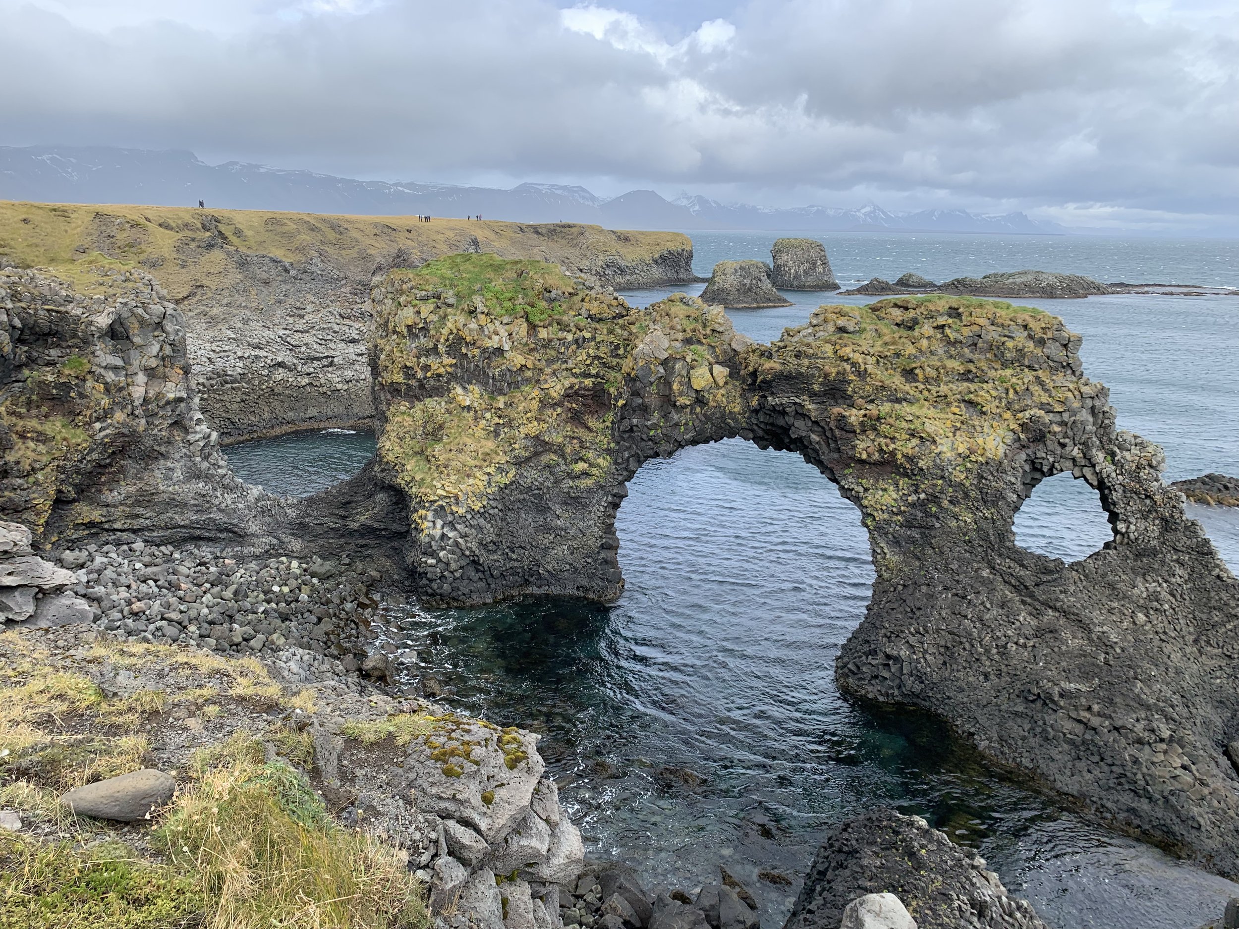
Gatklettur
Nowadays, not many families live in Arnarstapi all year round, but in the summertime, the place is teeming with both birds and people. There are many summerhouses in the area, boosting the summer population of this pretty and eye-catching harbour village.
Although its population has dropped over the years, this historic village, once such a vital trading post, is still a tourist hotspot due to the amazing scenery, quaint buildings – and Arnastapi’s ties to Icelandic mythology.
Once the home of Bárðar Snæfellsáss himself, a half-man, half troll immortalised in the Icelandic sagas, Arnarstapi is a place steeped in legend. Bárðar’s mother was human, but his father was half giant and half troll. Bárðar and his family emigrated to Iceland at the south shore of Snæfellsnes. He built his farm, Laugarbrekka. After one of his nephews pushed his daughter out to sea on an iceberg, Bárðar got very angry and threw one of the boys into a deep ravine and the other off a cliff (more about that later). Bárðar and his brother (the father of these two boys) then fought each other.
Afterwards, Bárðar gave away his land and vanished into the nearby mountain glacier. He became known as the “guardian spirit” of Snæfellsnes. He would help people that needed him and he wandered around the peninsula in a grey cowl with a walrus-hide rope around him, and a long staff in his hand which he used when walking on glaciers. The village of Arnastapi boasts a stone statue of Bárðar created by contemporary artist Ragnar Kjartansson.

Bárðar - half man half troll
Another reason for visiting Arnarstapi is to walk along the cliffs and take in the stunning views. Even on a cold and windy day it was worth the biting wind to breathe in the sea air and look out over the cliffs, which are home to arctic terns, kittiwakes and fulmars. From here, you can look out over basalt columns, sea arches, and caves. The view is just magical, whatever the weather. Gatklettur (Hellnar Arch) is a famous, naturally formed stone arch between Arnarstapi and Hellnar, a wonderful photo opportunity from the viewing point which has been created up on the cliff. If you turn and look inland, the scenery of Arnarstapi is dominated by Stapafell, a cone-shaped mountain that provides the perfect backdrop to the village’s charming wooden houses. With a couple of extremely nice and friendly restaurants/cafés, it made a good place to stop for lunch and a walk across the cliffs. In fact, on our second day we made our way back here and stopped here again for a coffee and snack – having the added bonus of chasing rainbows as we drove and even the chance to take more pictures of the cliff arch that juts out into the sea complete with rainbow.
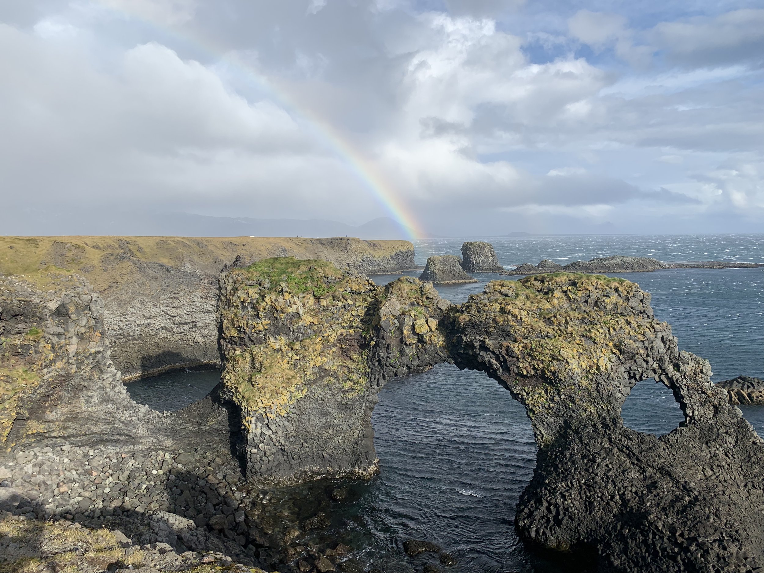
Gatklettur with rainbow
Djúpalónssandur Black Beach

The sweeping bay of black pebbles
Djúpalónssandur beach was one of my favourite places in Snæfellsnes. It is apparently very busy in the summer with the car park full of tour buses – the advice is to get there early and avoid the crowds. I felt very glad that we were here in October because there were relatively few people here and we were able to take our time and really enjoy this incredible place.
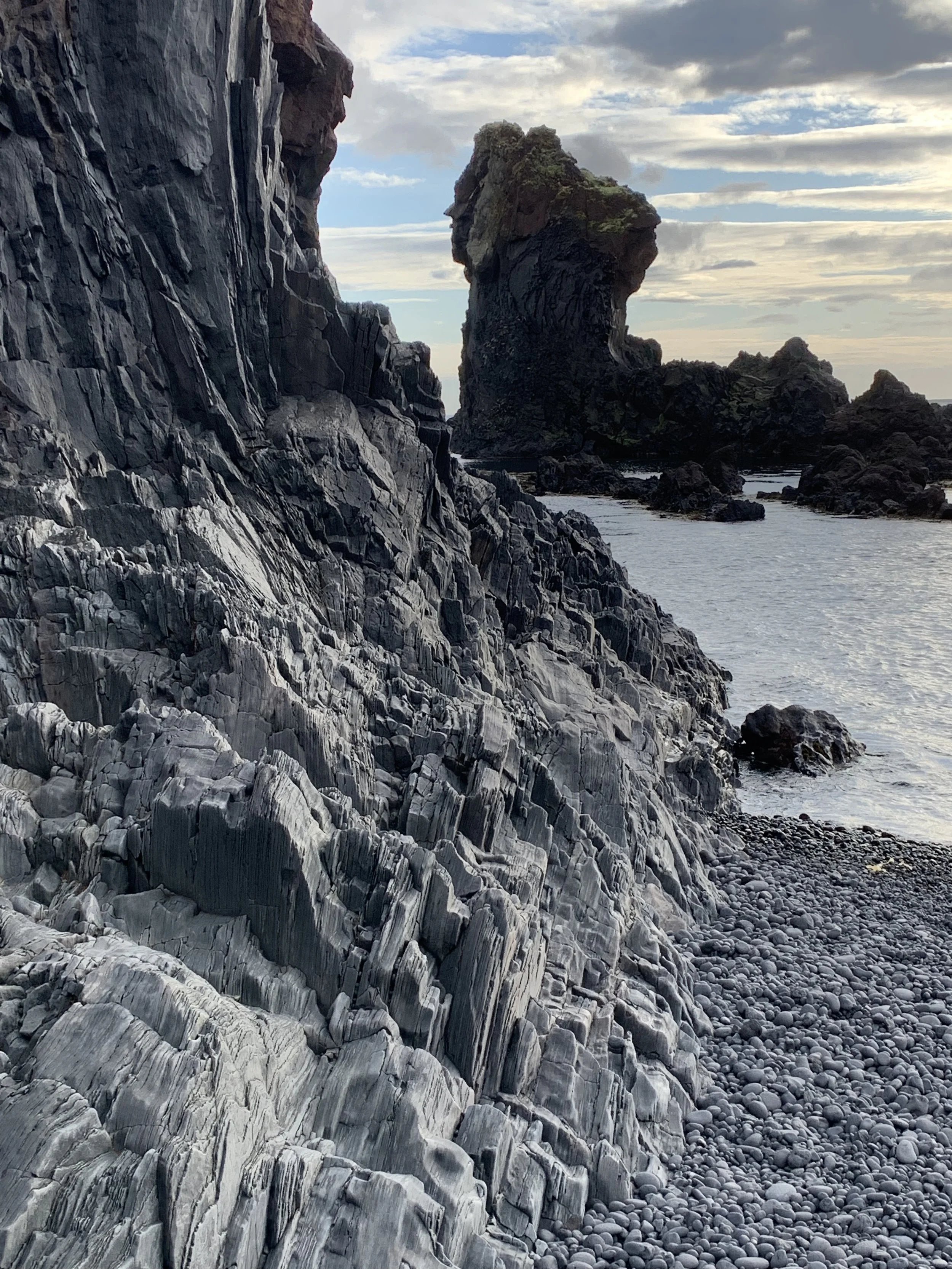
The stunning rock formations of Djúpalónssandur
Having parked in the car park we followed the sign to the beach which took us through a rocky canyon that is like something from a fairy tale – or perhaps Lord of the Rings. As we descend through this lava wonderland of huge mossy volcanic towers it felt as if we had left the modern world behind. With lava fields stretching as far as we could see, we picked our way through rocky outcrops and boulders down towards the beach.

The otherworldly path down to the beach from the car park
There is one volcanic outcrop that has a hole in it, and you can clamber up and peer through. If you look down there is a view of a deep still lagoon, and if you look up you can see the Snæfellsjökull glacier beyond the lava plains. This place is utterly magical! The path is apparently called Nautastígur (the bull trail) and the name goes back to a time when the bulls would be led down this path to drink at the lagoon.
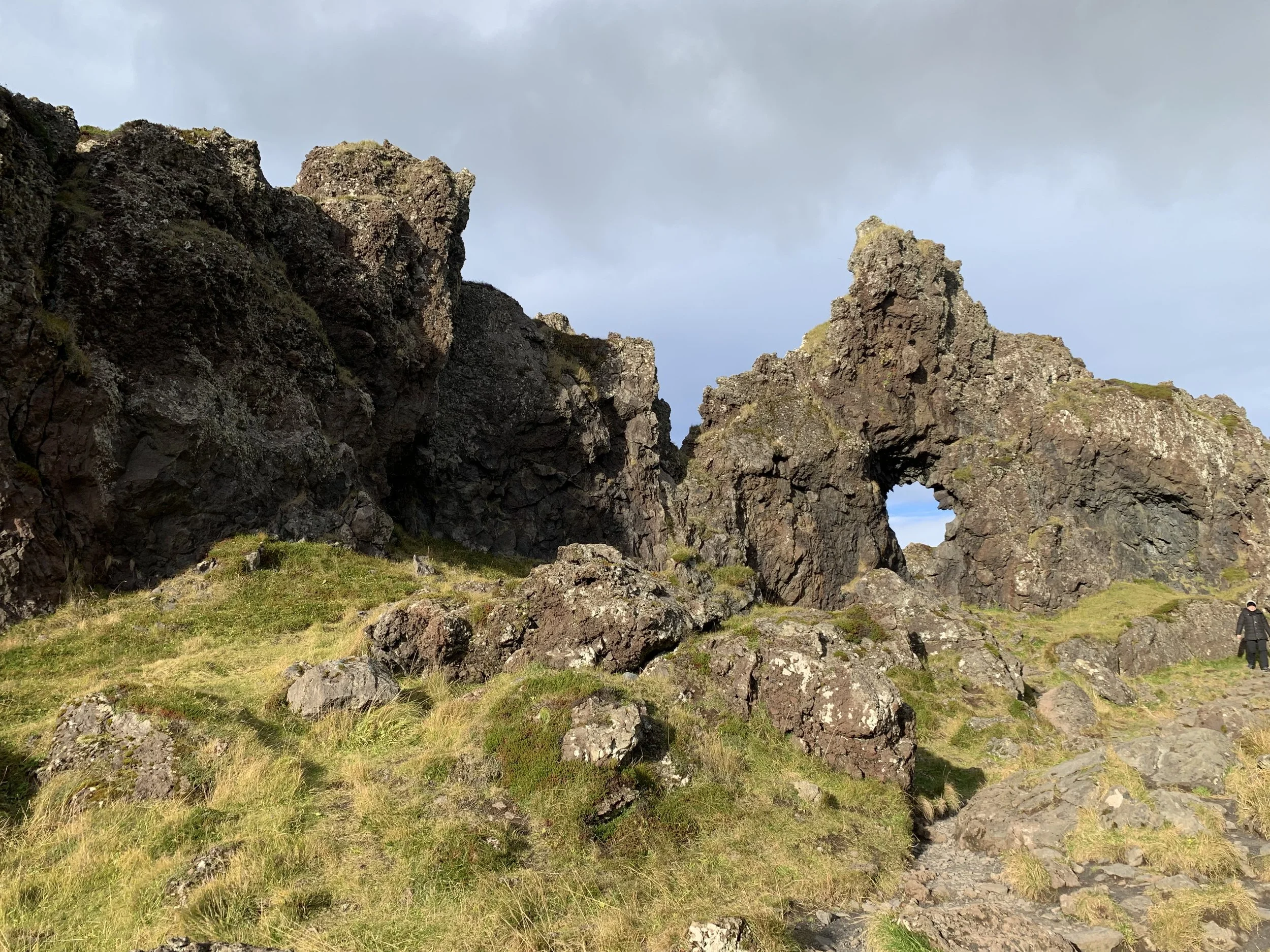
The rocky lava formations beside the path
There are actually two small freshwater lagoons behind the beach, called Djúpulón (Deep Lagoon) and Svörtulón (Black Lagoon) with the name of the beach itself coming from the former - Djúpalónssandur – ‘the Beach of the Deep Lagoon’. These lagoons are beautiful and there is a sense of calm as you walk around them. Again, the feeling is of a magical, almost otherworldly, place.

Looking across the first lagoon to the second, with the glacier in the background

The view looking back towards the beach from between the two lagoons
The black pebble beach at the bottom of the path and leading to the lagoons is wide and long and features lifting stones that were used to test the strength of fishermen. The four lifting stones are of different sizes and each had a name. They are Fullsterkur ("full strength") weighing 154 kg, Hálfsterkur ("half strength") at 100 kg, hálfdrættingur ("weakling") at 54 kg and Amlóði ("Useless") 23 kg. They were traditionally used to qualify men for work on fishing boats, the strongest being hired, with the Hálfdrættingur being the minimum weight a man would have to lift onto a ledge at hip-height to even be considered.

Modern day lifting stones
As well as the lifting stones, the beach also contains the scattered remains of a shipwreck. This was a British trawler from Grimsby, The Epine GY7, which was wrecked east of Dritvík cove on the night of the 13th March 1948. Fourteen men lost their lives and five were saved by the Icelandic rescue team from the neighbouring villages, which managed, after two long and cold hours, to get a line to the trawler. The iron remains, which washed up on the beach, are protected and there is a sign there asking visitors not to touch or take them as they are kept here in memory of those fishermen from England who perished. It seems extraordinary that after 74 years the remains are still here and have not been looted or taken for scrap and I wonder how many places in the world there are where these wishes would have been respected and the wreckage left…

The wreckage of the Epine GY7
As we walked down the beach itself towards the sea, we noticed a huge lava rock with a reddish hue on the beach. I didn’t know this at the time, but this rock is called Söngklettur - the Singing Rock – and is said to be an elf church. The Icelanders have a deep respect for elf locations and ask that people don’t make too much noise, climb the rock or otherwise show disrespect to the elves. If visiting a known elf-location one should always ask permission of the elves to visit their homes or churches and all will be well.
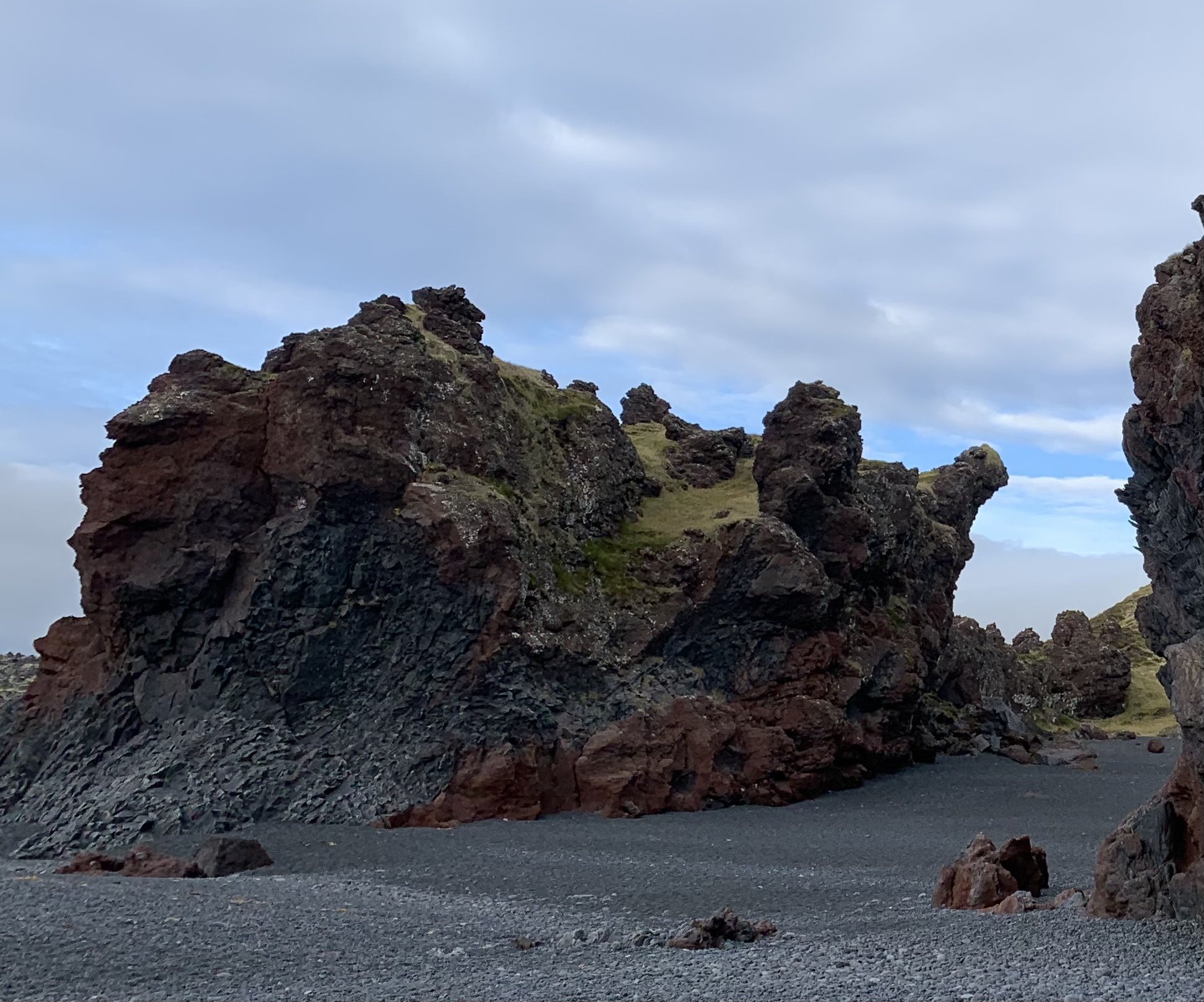
The singing rock - and elf church
I also discovered that some of the large rock formations are said to be trolls which have been turned to stone. It seems that trolls get petrified when they see daylight, and troll rock formations can be found throughout Iceland. The formation in this photo is called Kerling (troll woman) and is said to be carrying a bundle of fish on her back.

Kerling faces to the left, her face in profile, with her bundle of fish on her back
I didn’t want to leave Djúpalónssandur, and now that I know more of the history and mythology behind this incredible place, we will definitely be back for another visit soon.
Kirkjufell mountain

Right at the edge of the sea, Kirkjufell dominates the coastline
Kirkjufell is a mountain on the northern coast of Snæfellsnes near the village of Grundarfjörður. Fans of the Game of Thrones series will no doubt recognise it as it was one of the shooting locations. The name Kirkjufell means ‘Church Mountain’, the name coming from its steeple-like shape – and it is one of the most photographed places in the country.
The appearance of Kirkjufell itself is enhanced by a nearby waterfall, Kirkjufellsfoss. Though relatively small, this waterfall looks spectacular when set against the backdrop of Kirkjufell, and it is rare to see a photo of one without the other.
Kirkjufell is one of those places that has grown on me since being in Iceland. The first time I saw it I think my expectations were too high. The first time we had travelled to Snæfellsnes en route to the North, we had driven along the coast to see this amazing mountain that everyone was talking about. I had read that it was the most photographed mountain in Iceland, one of the top 10 most beautiful mountains in the world, and of course immortalised as “Arrow Head Mountain” on Game of Thrones. I hadn’t been in Iceland long when I first came to Snæfellsnes but I’d been here long enough to be blown away by the sheer size and magnificence and majesty of its mountains and rugged scenery so I was expecting something huge and imposing that would throw everything I’d seen so far into the shade… I remember as we drove, looking ahead and saying “But…? Do you think that’s it? It looks a bit like the pictures, but is that really Kirkjufell…?” and to be honest, I was a bit underwhelmed. Of all the spectacular scenery we’d seen since I’d arrived, I couldn’t really see why this was the most photographed mountain in Iceland. Because after some of the mountains we’d seen on our journey to Snæfellsnes, Kirkjufell seemed – well – a bit…. small. Even the Kirkjufellsfoss waterfall is really quite small. Pretty, with its three separate drops but, when compared to the likes of Seljalandsfoss and Skogafoss, definitely diminutive.

The thing is, Kirkjufell is not huge, like many of the mountain ranges in Iceland; it may not have that sense of majesty that others have, but it is very beautiful. And it took me a second visit to realise just how lovely it is. Much of this is due to its location; it is located right on the edge of the sea, and the scenery surrounding this mountain is simply incredible. In the summertime, the sloping green sides make the cone-shaped peak look very enticing – although I gather it is not an easy mountain to climb by any means, and not for beginners. I have read that if you have booked a guided hiking tour, you can be prepared for a relatively challenging climb up to the top where bird and fish fossils can be found! But if you haven’t booked a tour with an experienced guide, climbing to the top is out of the question as hiking it alone has proved fatal on many occasions. I am quite happy to stay at the base of the mountain and take pictures instead!
Kirkjufell was formed over millions of years by glacial erosion. It is very steep in all directions and layers of rocks are clearly visible from the bottom to the top. Due to its distinctive appearance it has been nicknamed Sukkertoppen or ‘the Sugar Top’. However, I rather think it looks like the sorting hat from Harry Potter….

This is another place you’ll need to arrive early, particularly in the summer and particularly at the times (usually around midday) when the tour buses tend to arrive, with crowds of passengers. I want to stay nearby sometime, so that I can try to get photos of it at sunrise and sunset – apparently the best times to photograph this very unusual mountain.
Berserkjahraun
When you leave Grundarfjörður, the road continues across a lava field named Berserkjahraun, which was created by an ancient lava flow some 4,000 years ago.

The eye-catching colours of the Berserkjahraun landscape
The name Berserkjahraun comes from one of the Icelandic Sagas, Eyrbyggja-Saga. According to the saga a farmer brought two berserkers from Sweden to Snæfellsnes and later gave the berserkers to his brother, Víga-Styr, who lived on the other side of the lava field. One of the Swedes fell in love with Víga-Styr’s daughter and asked for her hand in marriage. Víga-Styr made a deal with the berserker, he could have his daughter’s hand if the two Swedes could clear a path through the lava field, connecting Víga-Styr’s farm to his brother’s. The feat was considered impossible but the berserkers managed to complete the path quite quickly. However, instead of keeping his promise, Víga-Styr had the two Swedes killed and buried them near the path. As you cross the landscape (maybe on what used to be that first road across the lava field, I don’t know) the beautiful shapes formed by the lava are blanketed in soft green moss with shades of red and orange, making the landscape as colourful as its history.
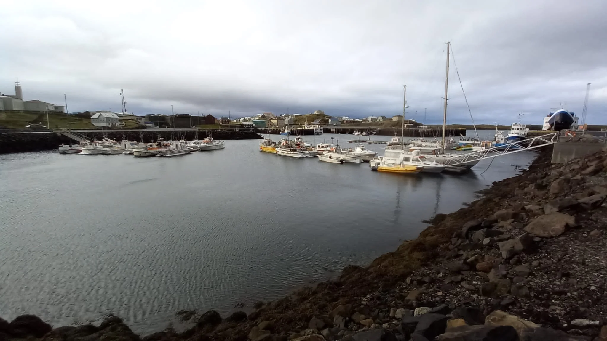
Stykkishólmur
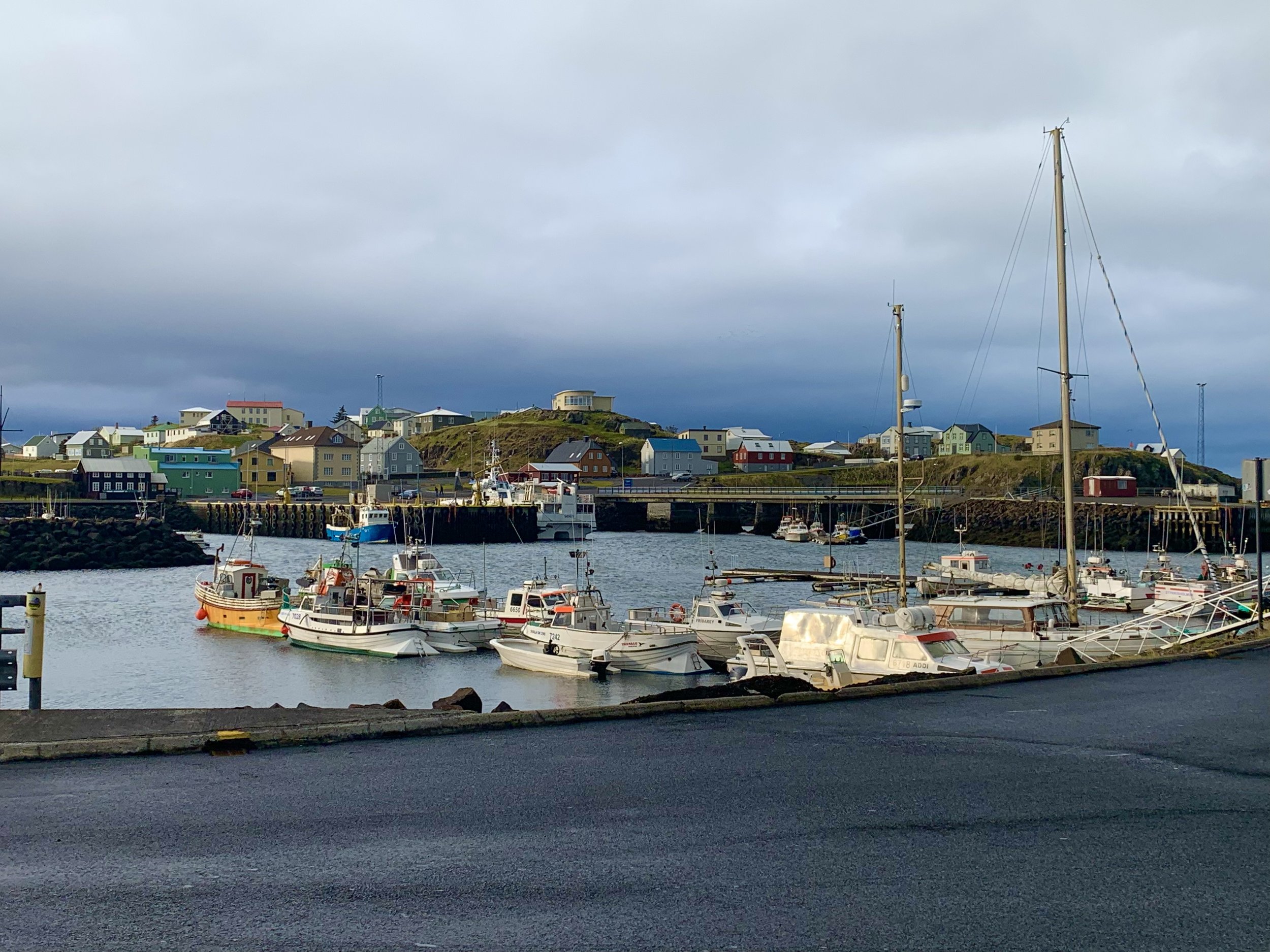
Stykkishólmur harbour
Stykkishólmur is a town of about 1,100 people, built around a natural harbor by Danish and Norwegian merchants. Although by no means huge, it is the largest town on the Snæfellsnes peninsula. With its brightly coloured traditional-style buildings and bustling harbour, this town is very picturesque and photogenic. Most of the homes date back 150 years giving the town a charming old and colourful look. It’s possible to take a ferry across to the island of Flatey from here, or even all the way to the Westfjords. Stykkishólmur was featured in the Hollywood movie The Secret Life of Walter Mitty, another film I am going to need to watch now to see some of the places we have been to. A couple of other random facts about Stykkishólmur are that the whole town offers free Wi-Fi and that plastic bags are banned from the entire town.

The view across the Breiðafjörður bay
This was where we stopped for the night, staying at the Hotel Fransiskus, located right next to the harbour. It was built in the 1930’s by a group of Catholic sisters who came to Stykkishólmur to build a monastery, a Catholic chapel and a hospital for the whole region. Although now a hotel, it still retains its chapel where the sisters of St. Mary´s pray every day. As we arrived the Saturday afternoon Mass was just beginning and there was a service there on the Sunday morning as well.


There are plenty of attractions in Stykkishólmur such as the Volcano Museum and the Library of Water (an art installation comprised of glass tubes filled with melted water from Iceland’s various glaciers),but we enjoyed just wandering through the town and around the harbour. We climbed the wooden steps to the top of the cliff overlooking the harbour to the lighthouse and had a wonderful view across the Breiðafjörður bay and the town itself. We also visited the futuristic church Stykkishólmskirkja, perched high on a hill overlooking the town. Its most prominent feature is a dramatic bell tower, made from two swooping concrete fins modelled on a whale vertebra.


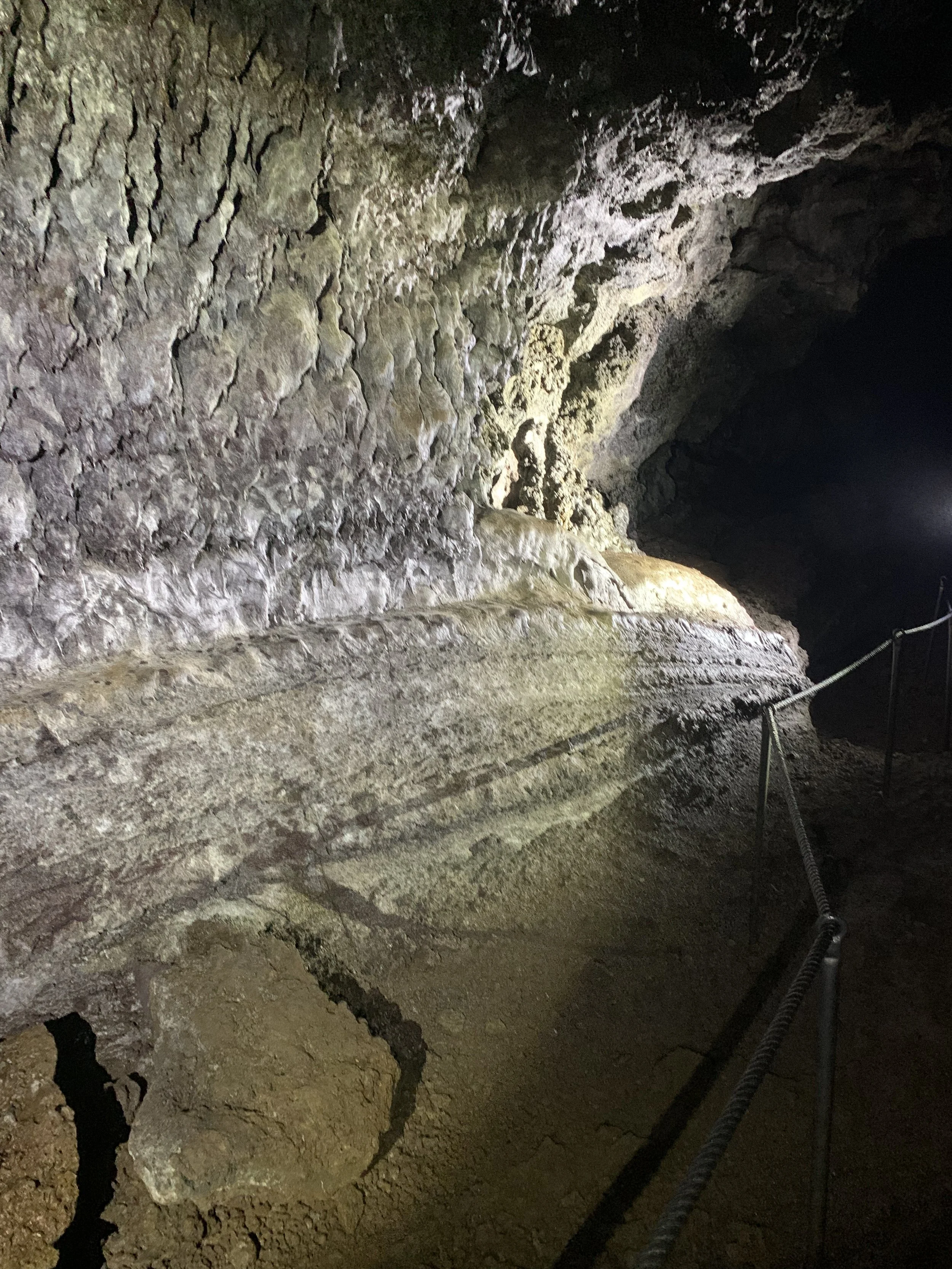
Vatnshellir Cave

The spiral staircase in Vatnshellir cave
On the Saturday as we had travelled around the coast, when we reached the westernmost end of Snæfellsnes and approached the start of the National Park itself, we saw signs for the Vatnshellir cave and lava tunnel. It looked completely closed, but we googled it and found that it was going to be open for two hours in the afternoon, from 1-3pm so we booked places for the Sunday. Vatnshellir is an 8000 year old lava tube, one of Iceland’s oldest lava tubes that can be explored (the other most popular tunnels being only between one and two thousand years old).
Vatnshellir was created when during an eruption, a river of molten rock began to cool from the outside in. The effect left a crust over still-flowing lava, which, after flushing away, left a hollow tube.
The minerals of this lava can still be seen in Vatnshellir today. The rocks are vividly coloured, with reds showing deposits of iron, yellows sulphur, and greens copper.
Vatnshellir is 200 metres (656 feet) long, with a deepest point of 35 metres (114 feet).


Visiting Vatnshellir cave was a unique experience. We had been warned to wear warm clothes with plenty of layers, gloves and decent footwear for the uneven terrain. Having prepared ourselves, with hard hats and torches we headed outside to the tunnel entrance; a wooden structure with hinged sides that opened up to a staircase leading down into the hillside. Once we reached the bottom of the steps we paused to explore the upper section of the lava tunnel. The upper section has great features and unique formations of lava statues curved on the sides of the lava tube. Our guide gave us the history of the tunnels, throwing in information about trolls and cave dwellers as well.


The lower part of the lava cave, which was reached by a long and narrow spiral staircase, took us deep down underground to a place which had been hidden from the outside world for thousands of years. It felt incredible to be standing in a tube of lava created some 8000 years ago in a volcanic eruption! In places, you could see the layers and striations in the rock marking the place where the lava had flowed down the tube. We stalactites, stalagmites, and mystically and wonderfully shaped lava formations. The glow of our torches created eerie shapes and shadows dancing across the walls of the cave. In the lower part of the lava cave, we were encouraged to all extinguish our torches and experienced total darkness and silence broken only by the sound of dripping water.


The tour took about an hour and was a fascinating exploration of a totally new world. As we emerged back into the daylight I felt a little like Alice emerging from the rabbit hole back into the real world. A wonderful experience and highly recommended.
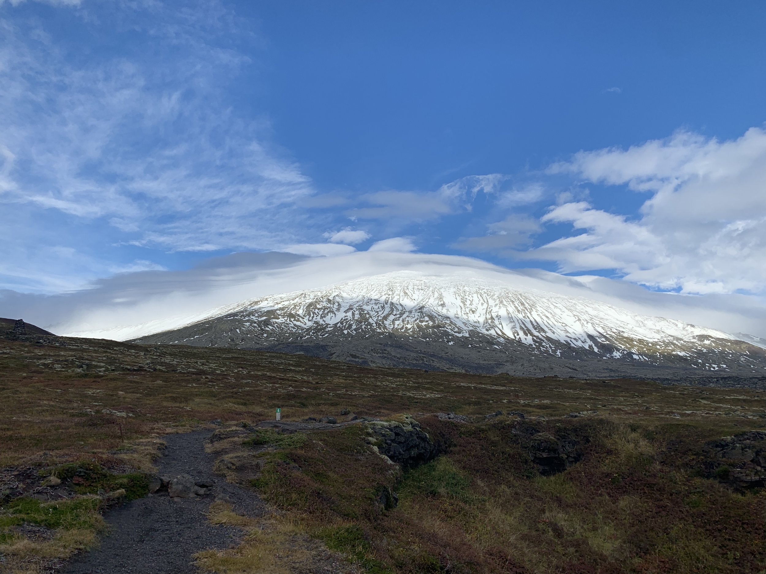
And the view we emerged to - the stunning Snæfellsjökull glacier
Rauðfeldsgjá Gorge
We had seen the signs for Rauðfeldsgjá Gorge on our way around the peninsula the day before, and decided to visit it on our way back from the Vatnshellir cave. By the time we got there, the wind had picked up and was higher than the previous day – I googled the wind speed as shown on the Veður (weather) app on my phone and discovered it was storm force, so it was fairly breezy! But Rauðfeldsgjá seemed worth a stop as we were passing.

The gorge seen from the road
Rauðfelsdsgjá (which means red coat gorge) is mentioned in a saga called Bárðar Saga Snæfellsáss, which was written in the 14th Century about events that had occurred half a millennium before that. The first part of the saga follows the half-giant Bárðar, who upon death later became the guardian spirit of the Snæfellsnes Peninsula.
It was said that his daughters would play with the local boys. One of these boys pushed one of his daughters out to sea on an iceberg, where she drifted all the way to Greenland. Here, she found a lover, but Barður, thinking she was dead, grabbed the two brothers and climbed to the cliff above the ravine. In his uncontrollable anger, he threw Rauðfeldur into the ravine and threw the other brother Sölvi of the cliff. Both boys died, but their names have lived on as the ravine, and the cliff bear their names; Rauðfeldsgjá and Sölvahamar. After this incident, Bárður lost his mind and eventually walked up to the glacier where he built an ice cave where he lived for many centuries (and according to popular belief, still does to this very day).


Upon arriving at Rauðfeldsgjá, it is not surprising that it features in the ancient sagas. This is an beautiful and mysterious looking place, the imposing craggy Botnsfjall Mountain blanketed in fuzzy green moss. The gorge itself isn’t obvious—you need to walk about 10 minutes from the parking lot up the hill to reach the narrow opening where a stream gushes out and you can see the deep, high and narrow ravine.
It’s easy to enter the canyon but to go any further you have to clamber on rocks over the small falls. Most of the people who were there when we went, contented themselves with stopping at the entrance and looking up at the stream and falls that you can see deep in the ravine, but if you are happy to get your feet wet, you can wade in, using the stones as stepping stones in places, and follow the ravine until you get to the small waterfall. It is possible to climb up the waterfall and on into the ravine itself, but the guides all warn that this should only be done in the summer time as it can get very slippery, particularly when icy.

Matthew disappears deeper into the ravine
Given the weather conditions, and the fact that the further in we went the wetter we were likely to get, we decided to exercise caution and go no further than the waterfall. It still felt quite intrepid clambering over the rocks in the stream to go deeper into the fissure in the rock and we enjoyed the opportunity to explore.

The view on exiting the gorge
Emerging out into the winds again, that were threatening to blow us off the path at one point, I was glad we hadn’t got any wetter than getting soaked feet and calves. The journey back could have been a little less comfortable had we tried any waterfall climbing!!


As mentioned earlier the change of weather as we drove back meant that we were driving into rainbows for much of the return journey along the south coast. Given the changeable weather in Iceland, rainbows are fairly common but it felt particularly apt in this wonderful, changeable part of Iceland that we should encounter rainbows as well. Snæfellsnes is truly a magical place with so much to see and do and this will definitely not be our last trip through this wonderful landscape.
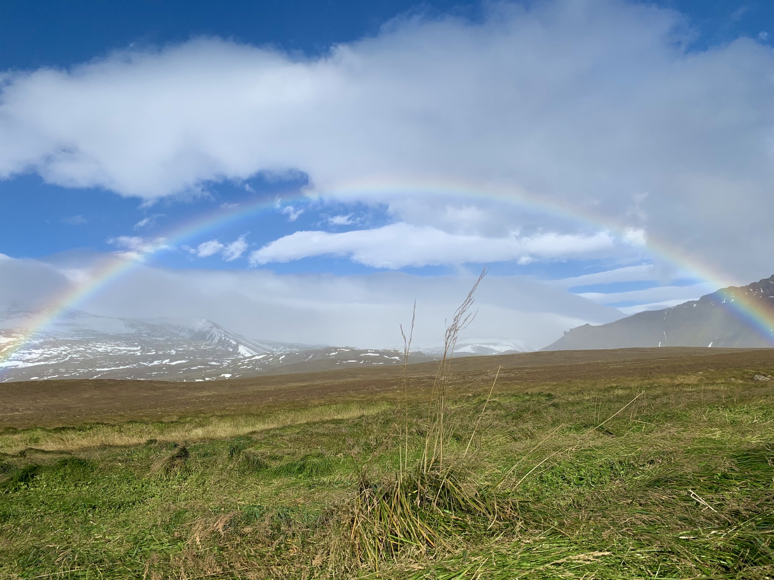
One of the many rainbows of a very special weekend