Stuðlagil Canyon
Stuðlagil Canyon
I first found out about the existence of Stuðlagil Canyon thanks to Imogen. I was at home on one of my regular visits to the UK and we were looking together at bucket list places to visit when in Iceland. Imogen was checking out TikTok for recommendations and came across some pictures on there that were just stunning. A gorge, made up of incredible basalt columns in the weirdest shapes and configurations, along the side of a river that was the most improbably deep blue-green that I was convinced photoshop or filters had been employed. But even allowing for the use of filters, I knew I wanted to visit this place. It was clear that you could even walk alongside the weirdly coloured water in places and I was determined that I would go.
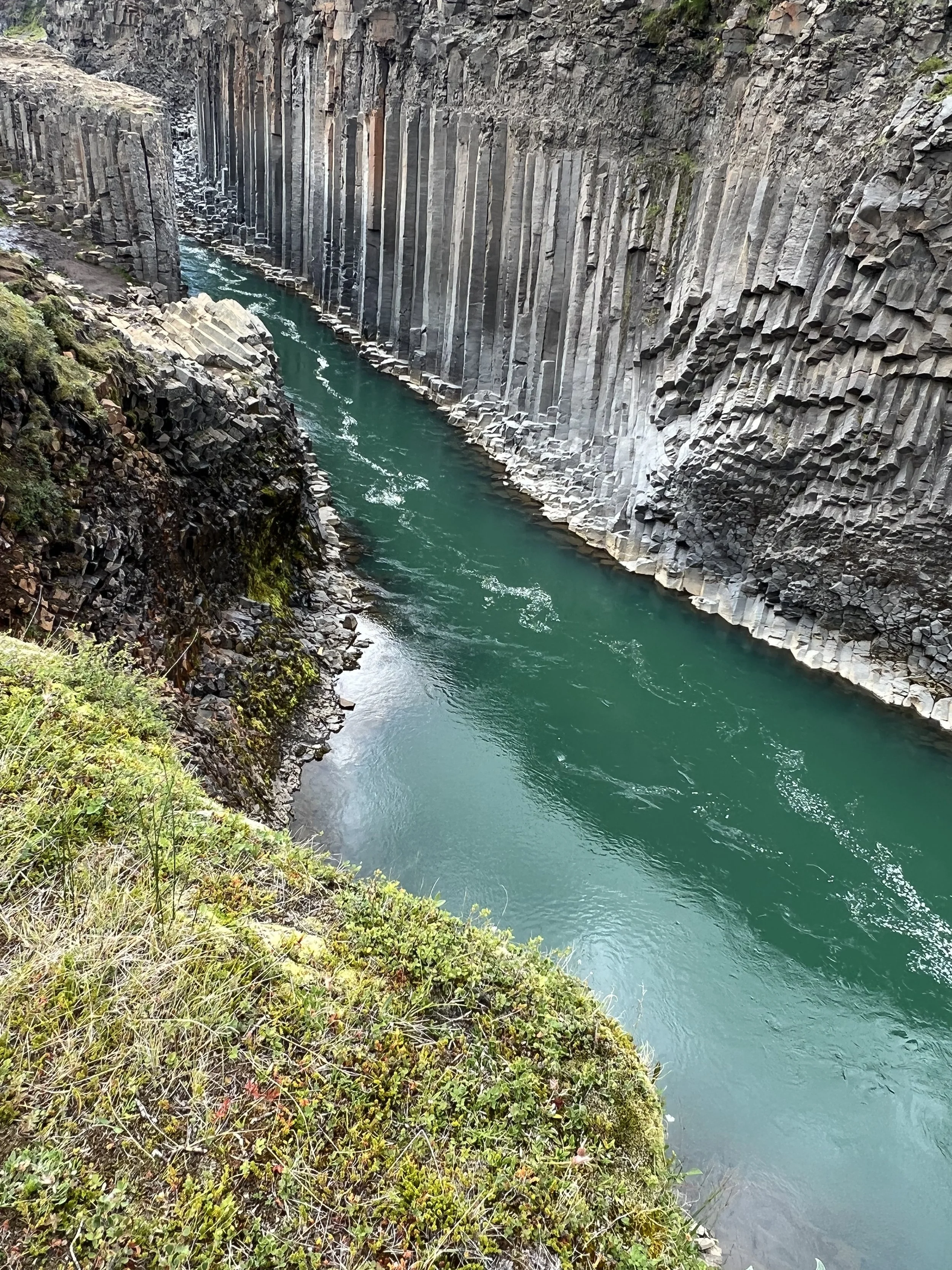
The blue-green water contrasting with the basalt columns
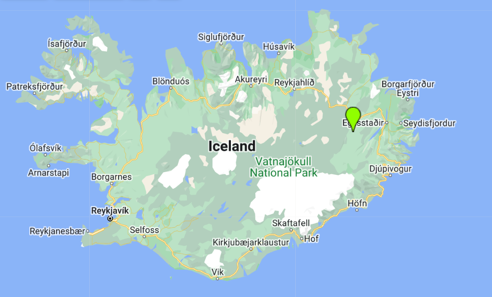
This amazingly instagrammable gorge was of course Stuðlagil, and a bit of research revealed that it was way over to the East of Iceland, which was partly why I’d never heard of it up to that point. Based, as we are, right over on the West coast of the country, it’s a very long drive (or a rather expensive internal flight) over to Egilsstaðir, the largest town over to the east. Stuðlagil is then some 52km from Egilsstaðir and will take a good hour to drive, followed by a reasonably long hike. So I noted it down for the future, and from that point on I was determined that in the summer we should try to travel eastwards to visit that part of the country.
Which brings us to now and this week-long holiday in the East of Iceland. It was an area I wanted to visit anyway, and my desire to see all that Iceland has to offer would have made this trip inevitable at some point, but it’s not an exaggeration to say that the day spent looking at pictures of this canyon with Imogen in England, was the impetus for this whole trip.
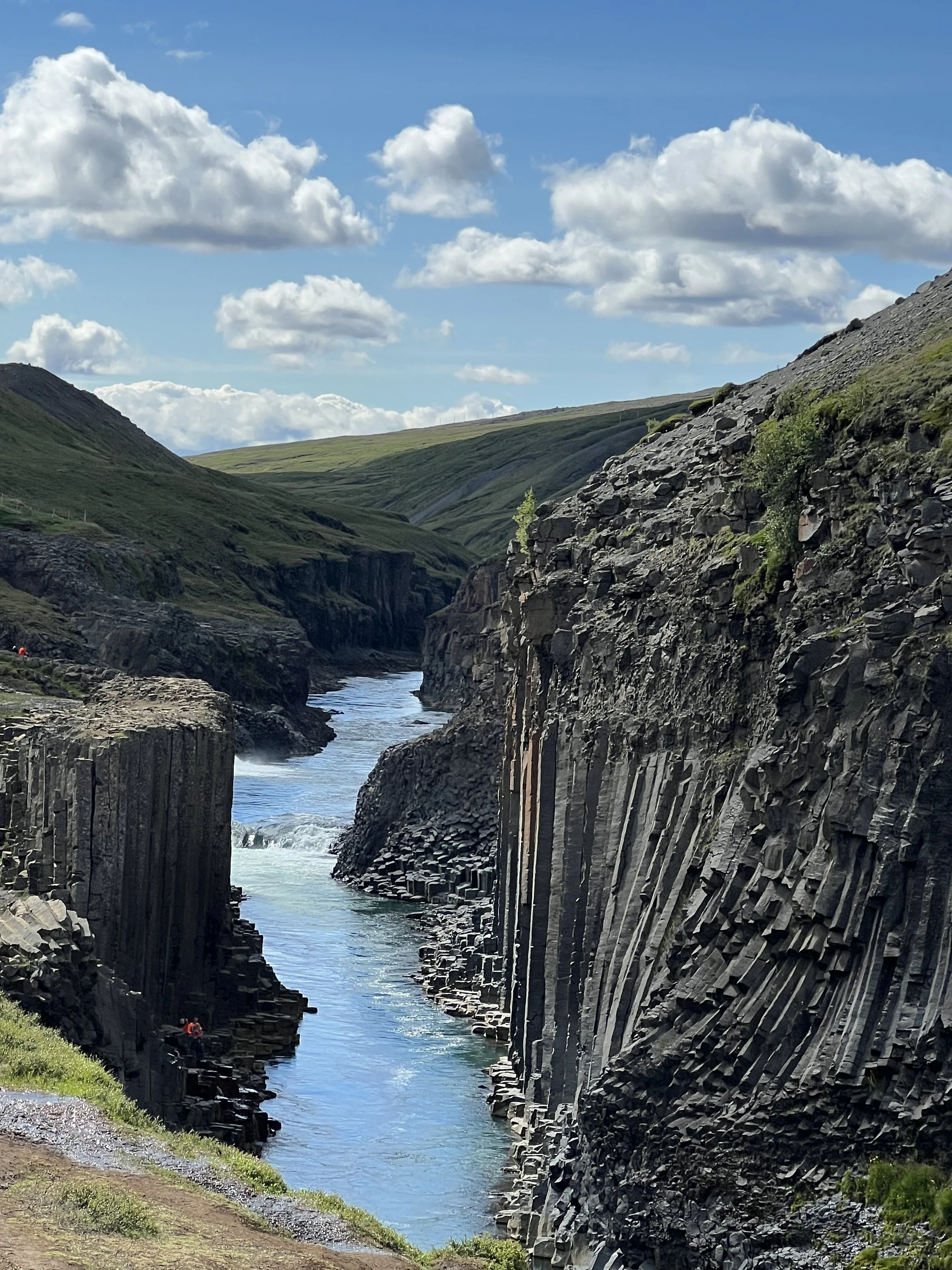
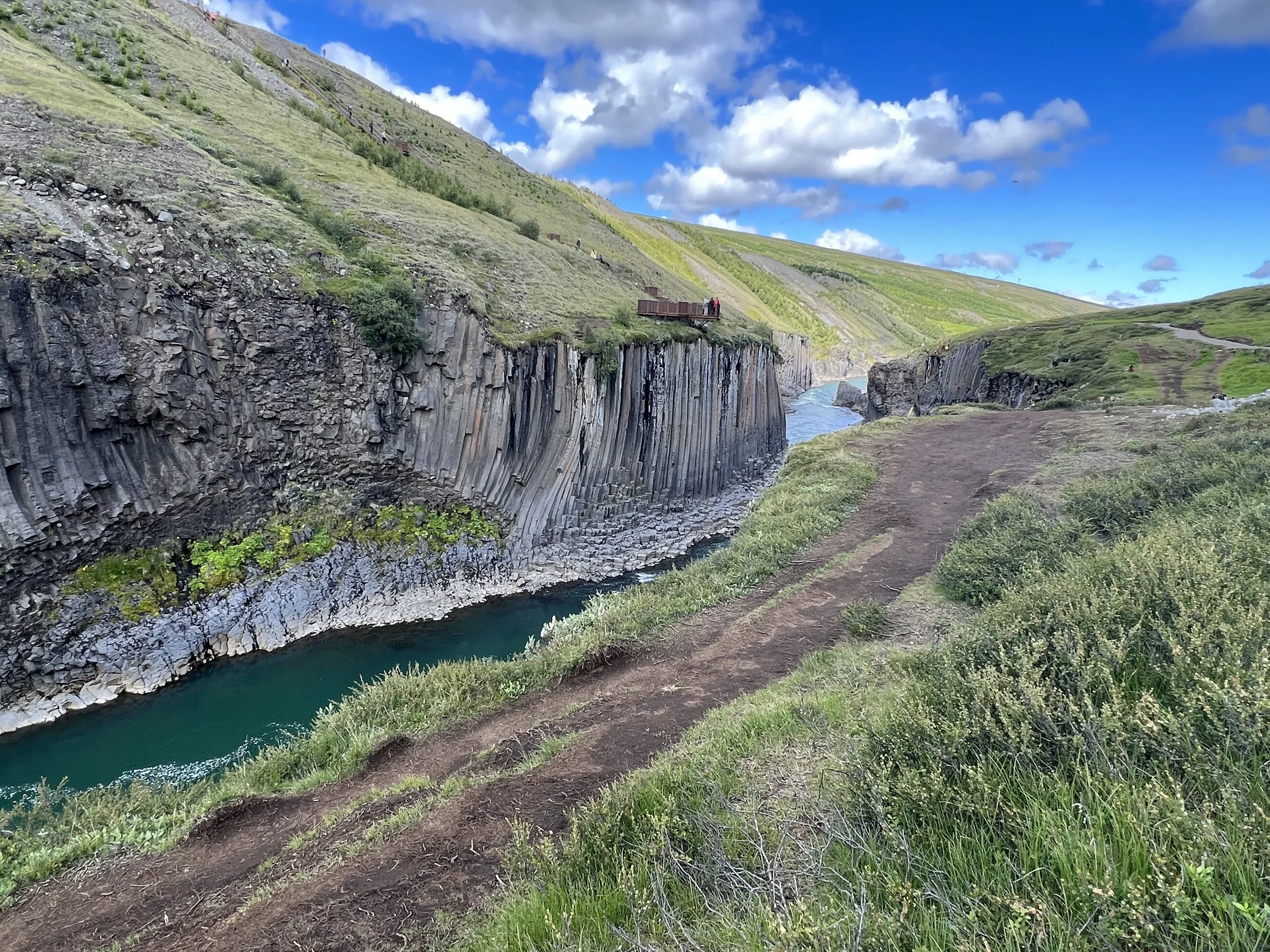
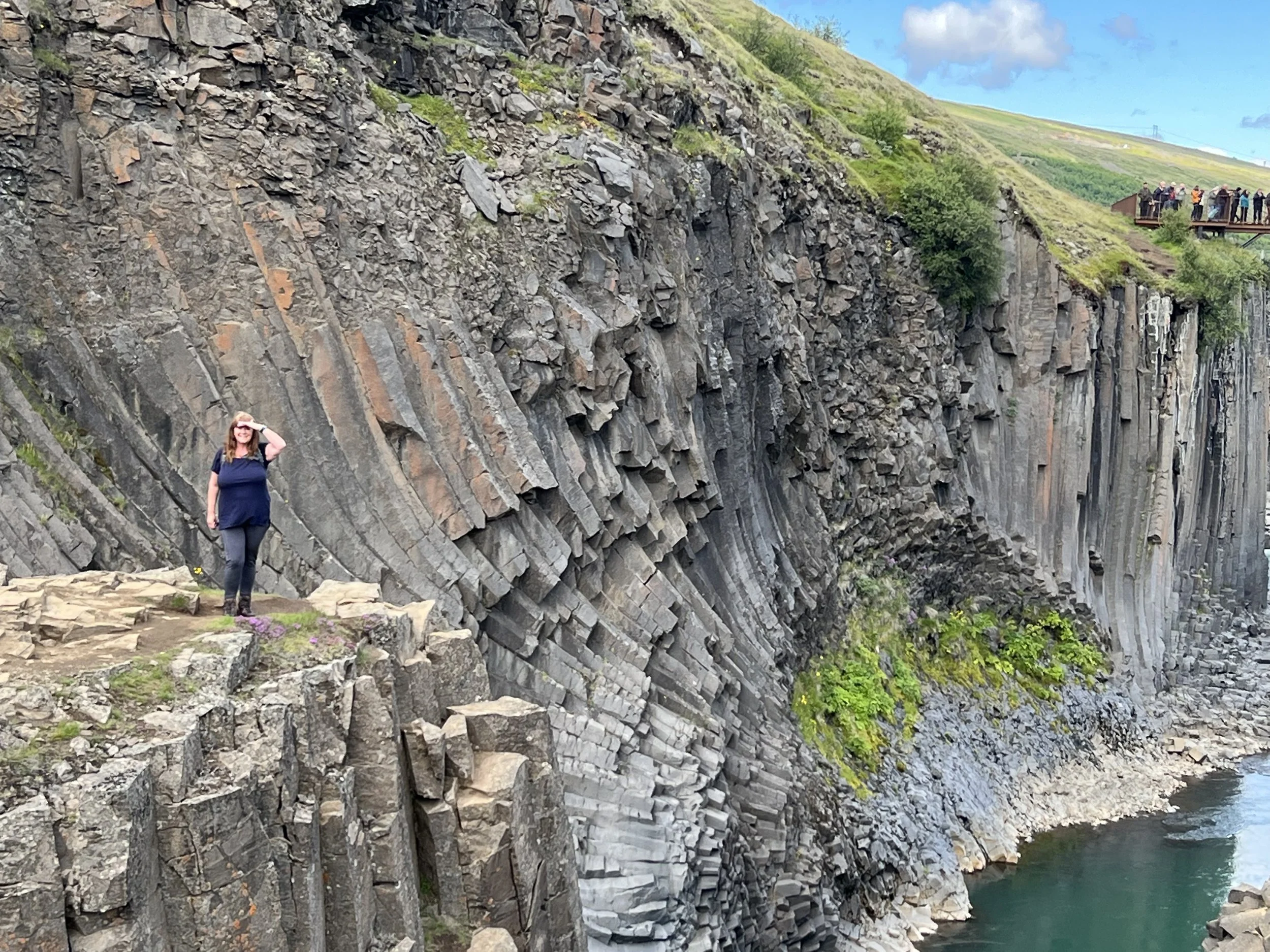
The hiking trail to the left of the Stuðlagil Canyon and the viewing point far ahead on the right
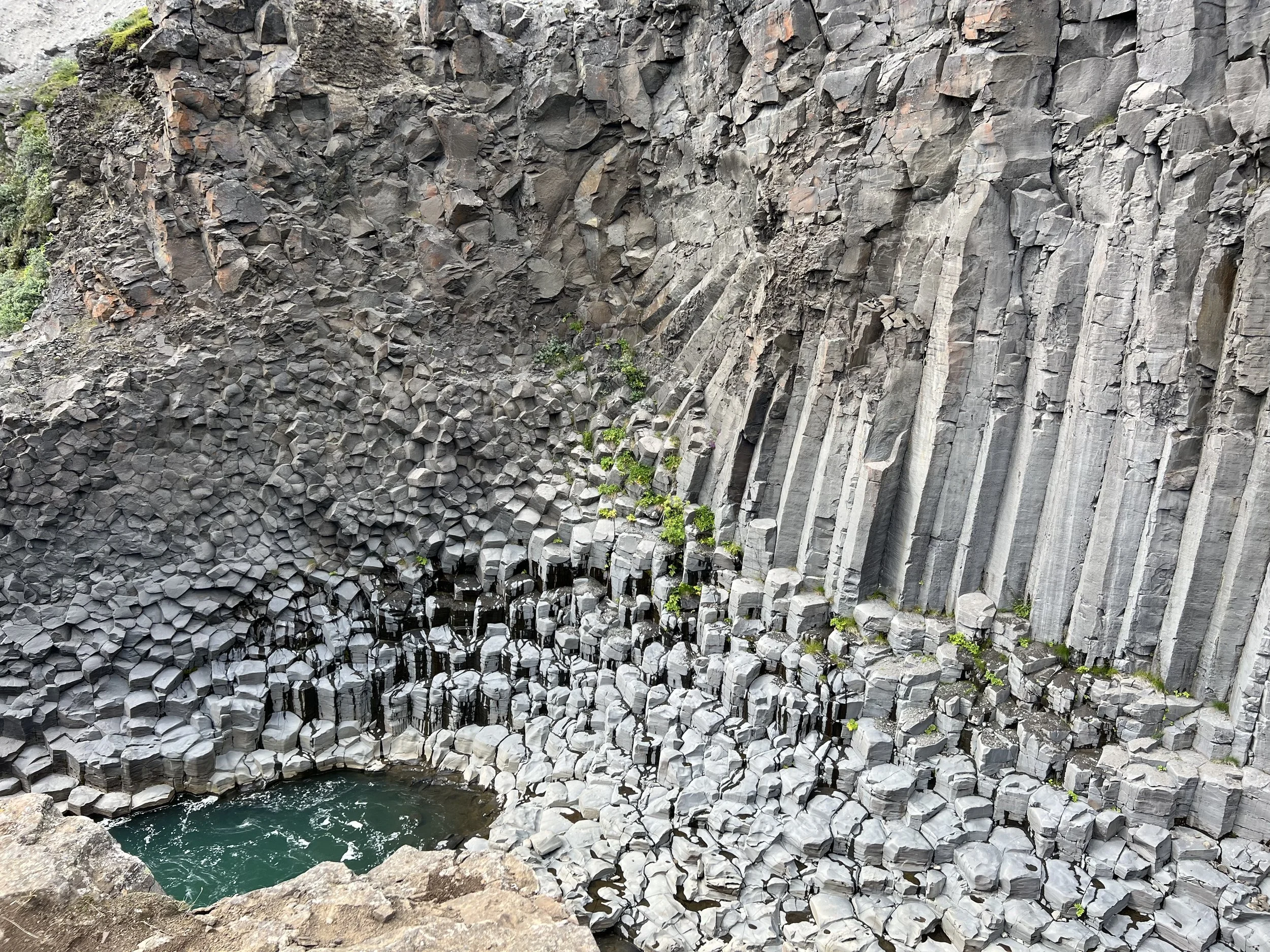
It seems that the beautiful blue stream is a relatively new phenomenon as, until fairly recently it was a raging torrential river called the Jökulsá á Dal. However, that all changed with the creation of the Kárahnjúkavirkjun hydroelectric power plant and the Hálslón reservoir between 2003 and 2007, which diverted much of the river water through underground tunnels. The plant began operating fully in 2008 and the total water level dropped by some 600m! What remained was a small river supplied by mountain springs and glacial runoff with the most amazing basalt columns either side, which had been totally invisible under the water line of the original river! The other advantage of the drop in water volume is that the huge amounts of sediment that previously had turned the river brown are now (unless you visit during the rain) a thing of the past, leaving clear, blue glacial water in its place.
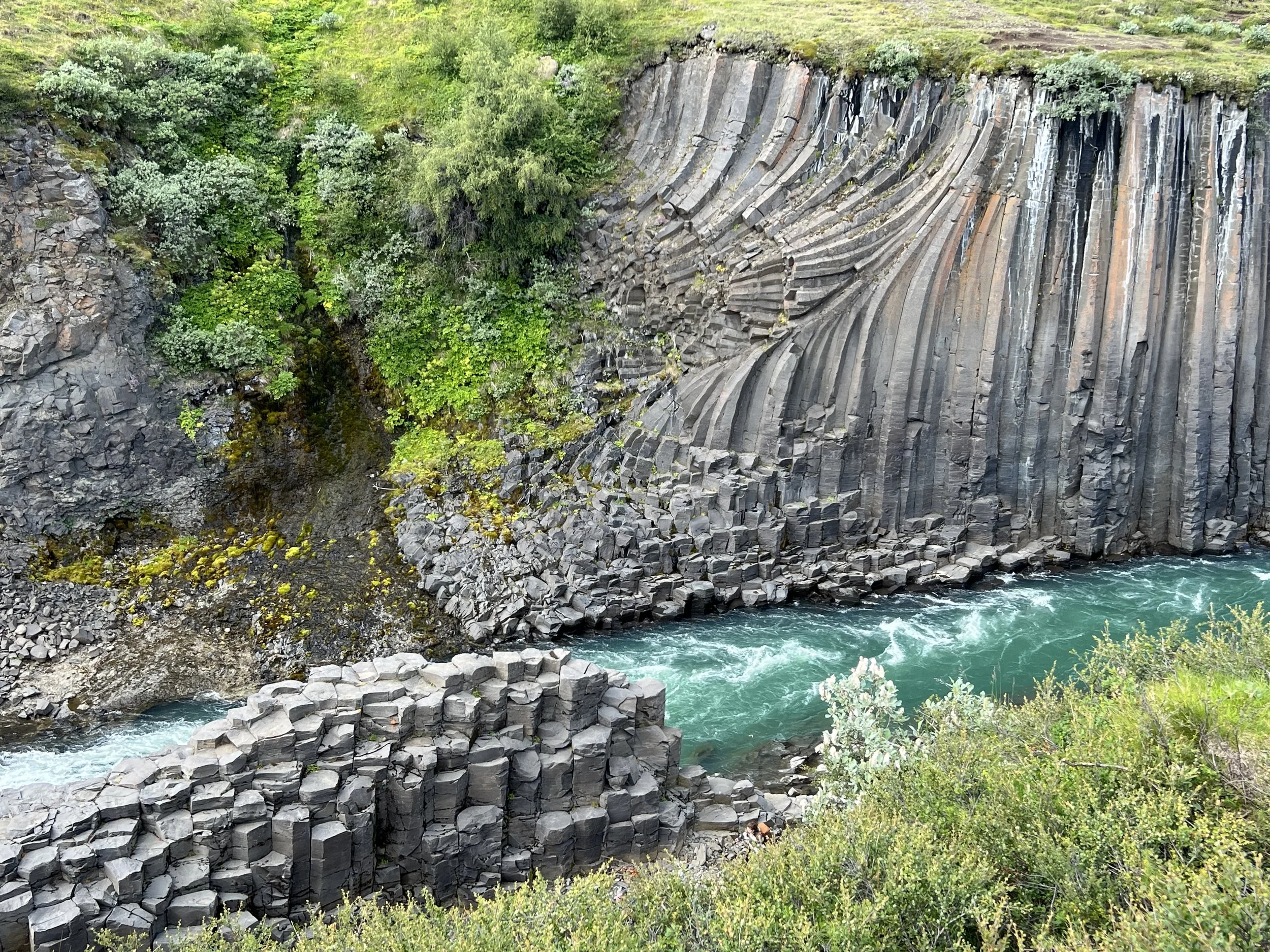
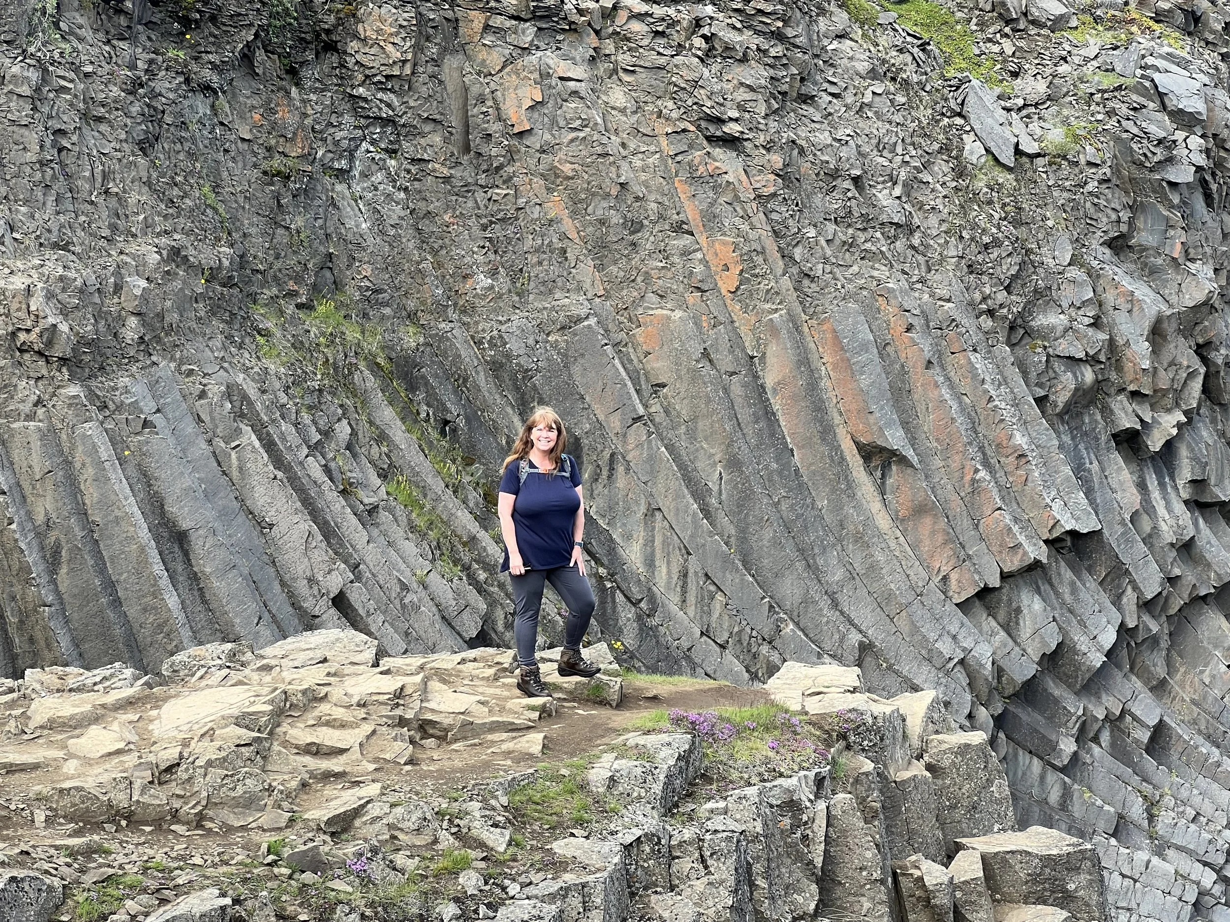
I was fascinated by the way that the stone basalt columns bend and move
Apparently, it was only in 2016 that a local guide discovered this formerly hidden canyon. The Stuðlagil canyon became famous on social media by 2019, and so considering the lack of tourists during the Covid pandemic, it is very much a new phenomenon.
Amazing to think that none of this was visible, hidden in the depths of the river
I had spoken to a couple of friends who had already visited Stuðlagil and who had been a little disappointed, having not seen the amazing blue-green water that featured on the pictures I’d seen, but instead a river of dull greyish brown. This was when I discovered that in the springtime when there is an overflow from the Hálslón reservoir, the sediment is stirred up, making the river murky again, and also when there is a lot of rain the same thing happens.
We knew our chances were good with the season, as we were visiting towards the end of July, but we had had a lot of rain in recent days and weeks, so I was unsure if we would get to see it at its best. However, we checked out the weather forecast for the week and decided on the best day to go and headed off from Egilsstaðir, fingers crossed for clear waters.
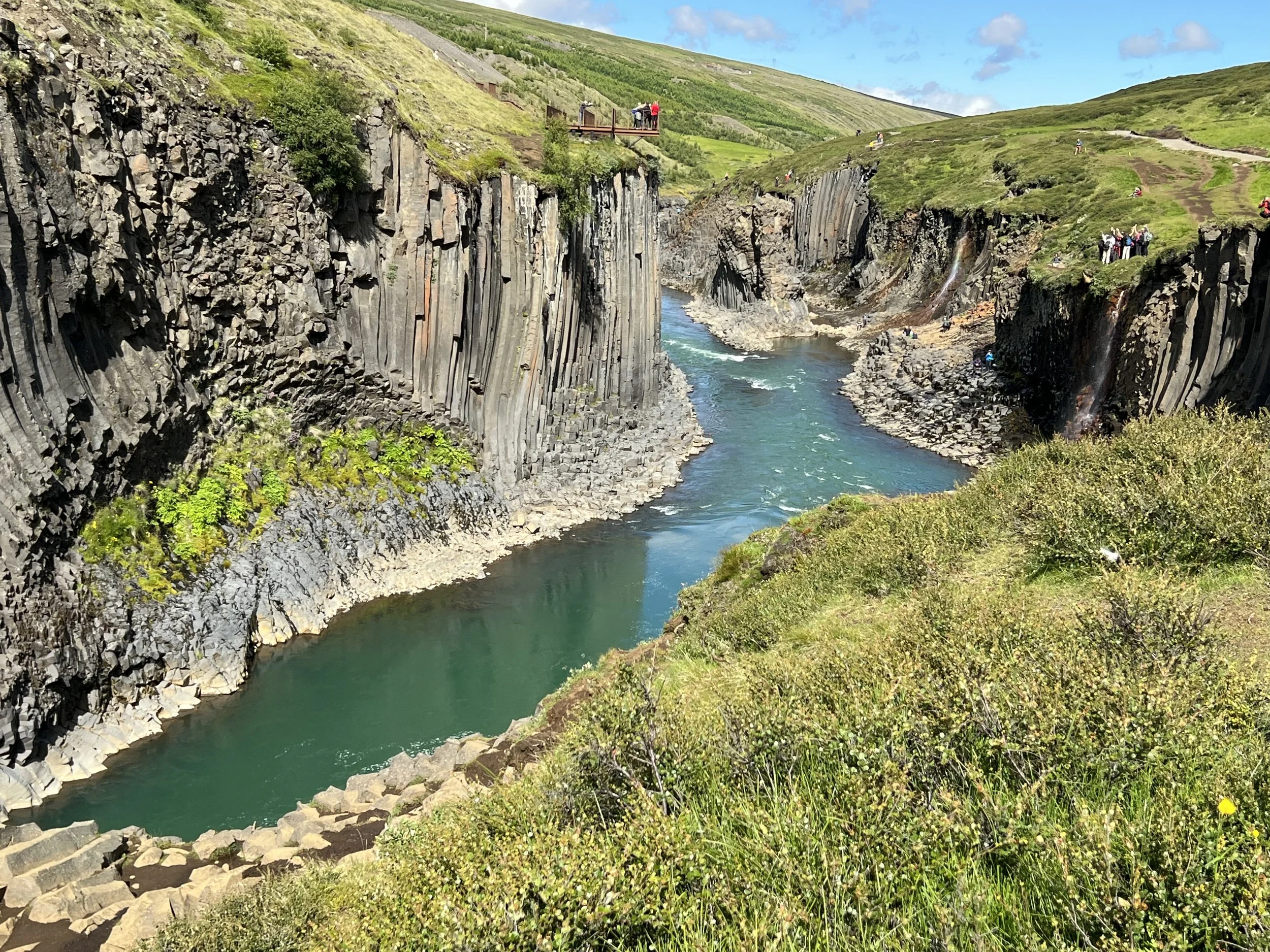
Looking across at the viewing platform on the other side
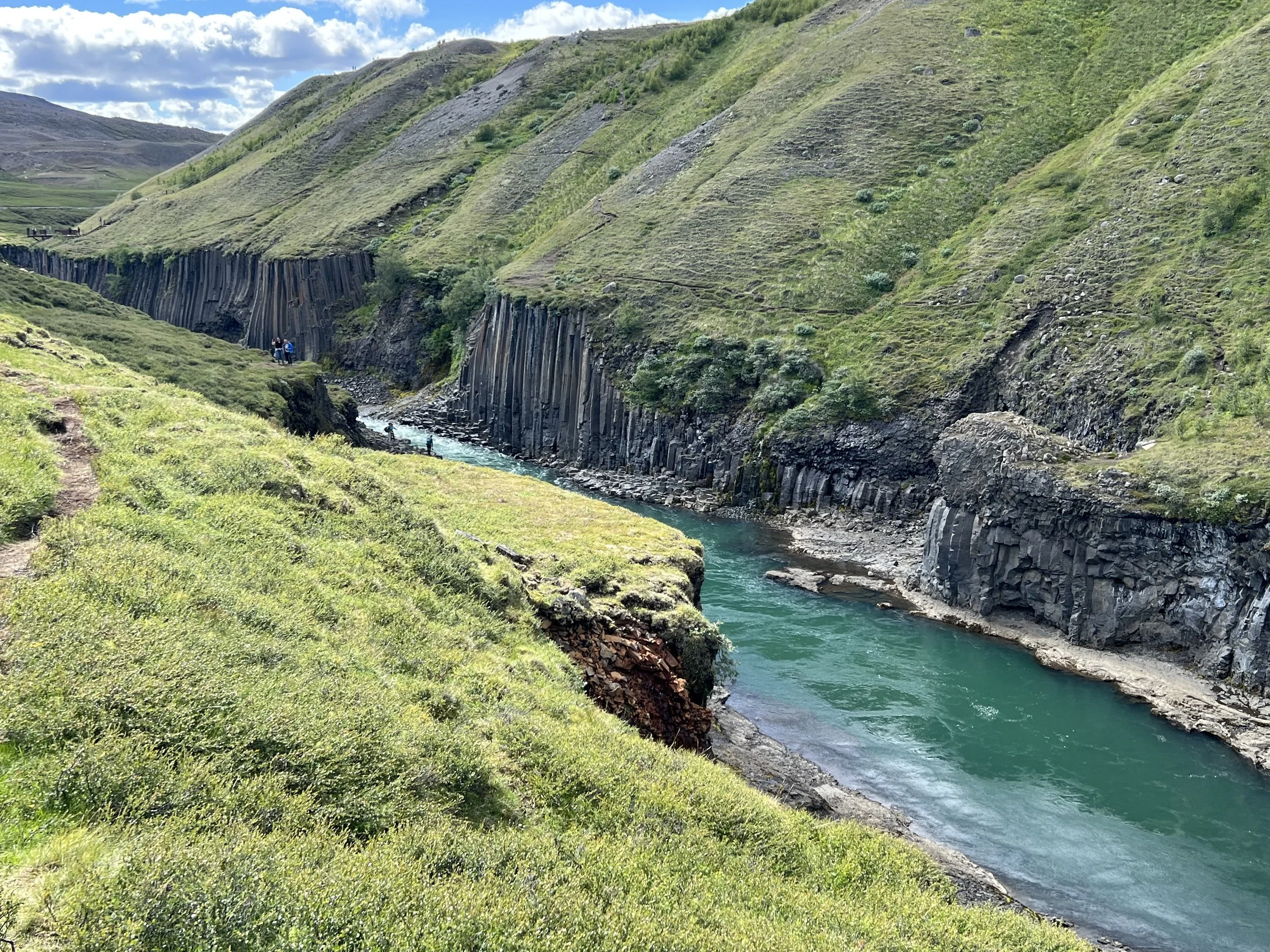
We were a little unsure of the way there, as there are two routes; one to a viewing point on one side of the canyon and the other to a hiking trail on the other side. We headed for the hiking trail, following the instructions we had been given, which took us to a point where many cars were parked. We could see people walking along the road from the parking lot, but also one or two cars that were going further, so we decided to chance it and see if there was a place to park nearer the canyon. After a couple of kilometres we came to a second car park which was almost full but we were very lucky and managed to find a space as someone else was leaving. We found out later that we had saved about 5km of walking by travelling on to the second parking area. We locked up and set off on foot from the car park. The walk from here was a few kilometres but we soon left the dusty road and the way became more of a path and much prettier.
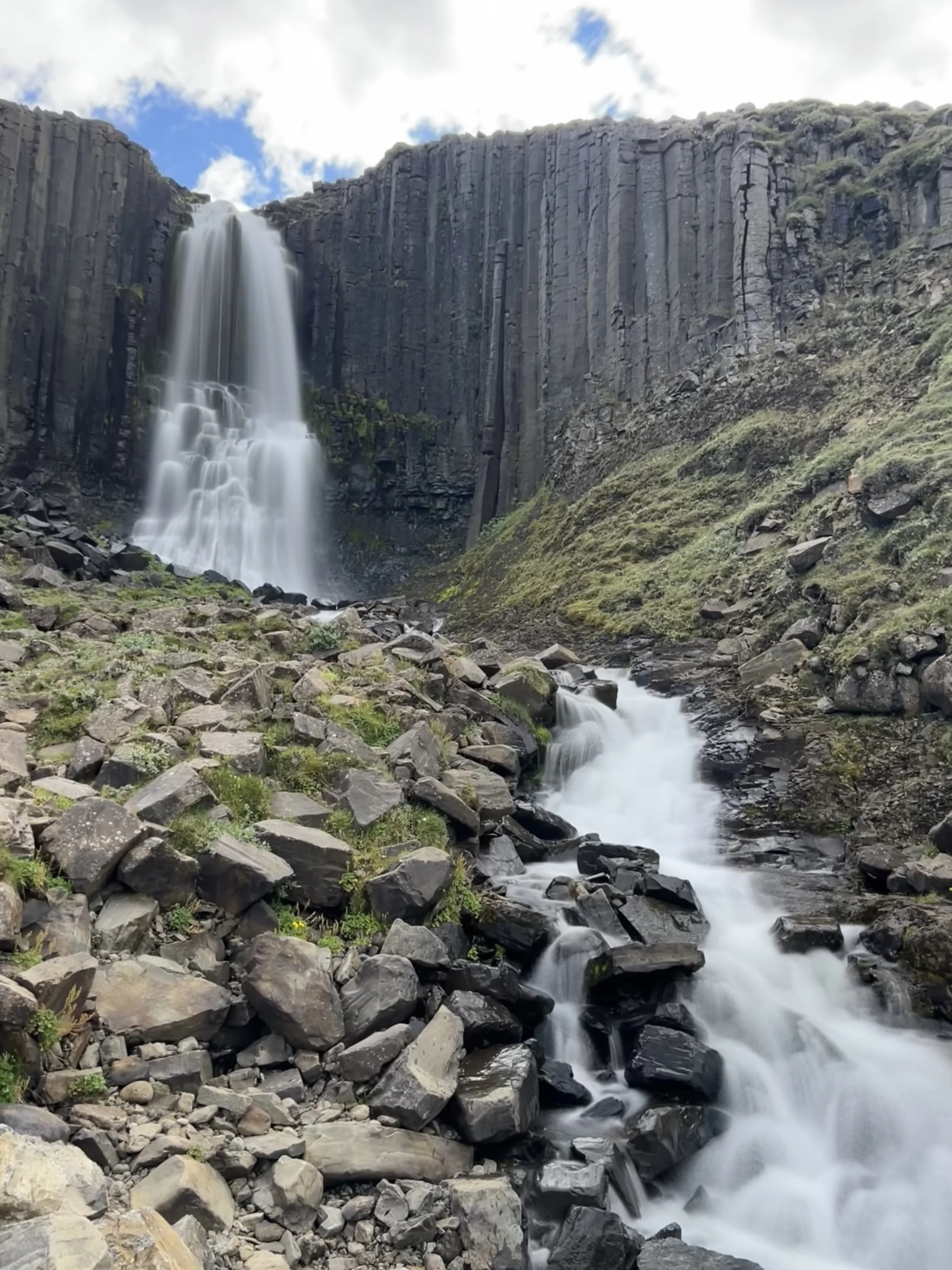
The waterfall at the beginning of the walk
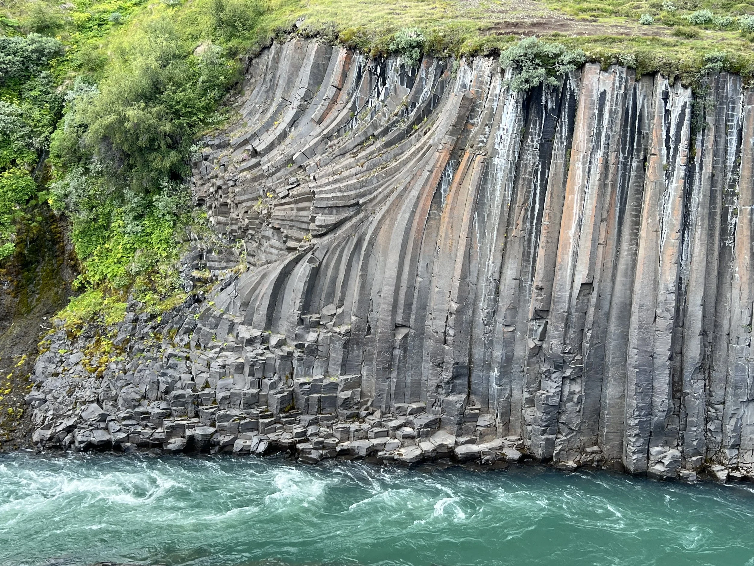
After only a short walk we came to a lovely waterfall on our left, flanked by basalt columns, that flowed down the slope into the river below. I have no idea if it is a named waterfall but it was very pretty. The walk too was very pretty with the canyon to our right and the river bed at the bottom. It became clear very soon that we were in luck, as the water was a striking blue colour, and before long we could see the beginning of the rock formations that feature on so many photographs of this place. The Jökulsá á Dal river is one of Iceland's longest glacial rivers and stretches about 150 km from Vatnajökull glacier to the sea. The river can feature strong currents and people are warned to take care when in the area.
Stüðlagil boasts one of the largest and most beautiful rock formations in the country and is extremely picturesque, especially when the river is clear. The blue-green color of the water, which is named after the colorful rock, is just stunning. No filters needed!
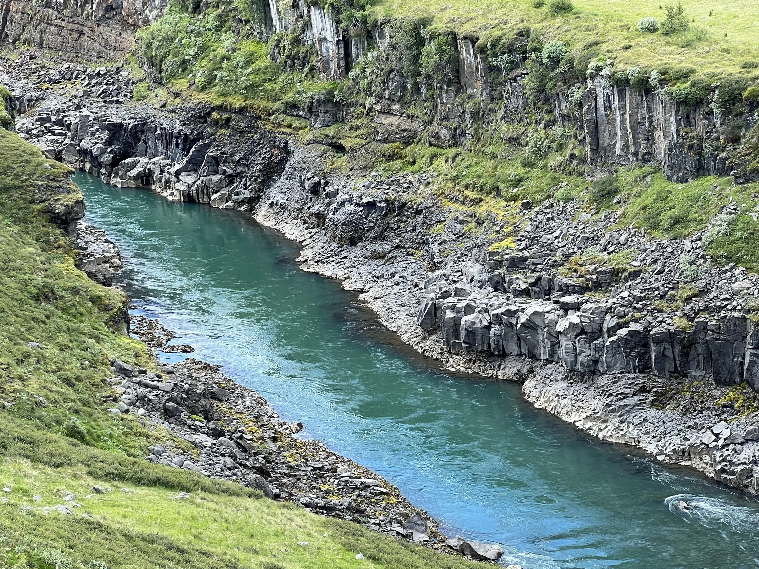
The deep bluey-green colour of the water was mesmerising
As we walked, we kept diverting off as we saw little paths that snaked their way down the side of the valley towards the river and so we took a lot more time than we needed to with all our clambering down and back up the steep sides of the gorge, but it was an amazing hike, with many, many stops for photographs.
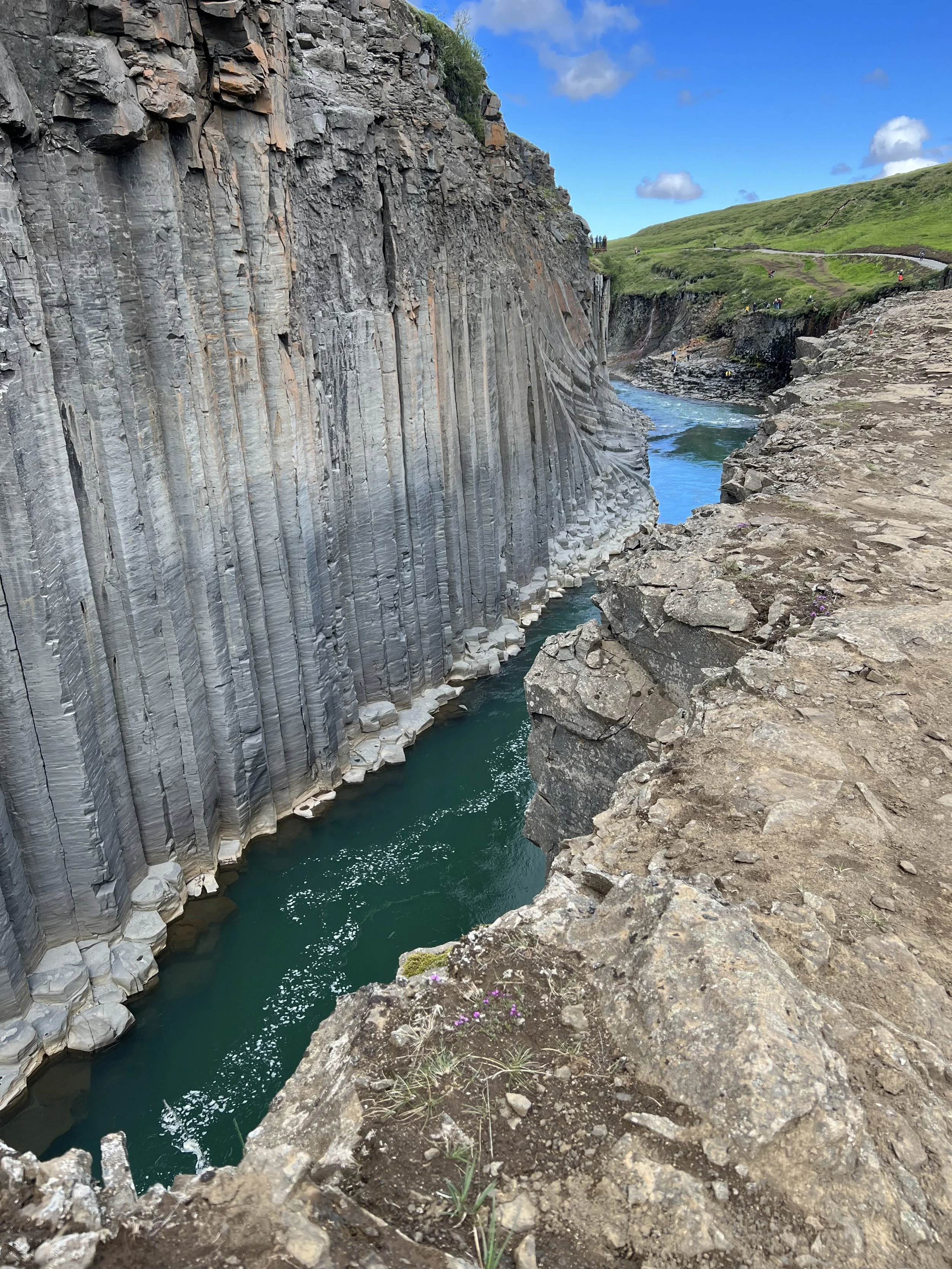
A little way along the gorge, we could see the viewing point on the other side; a steep set of steps down the side of the valley ending at a cantilevered platform at the top of the basalt columns. However, the side we were walking along was far less picturesque, with far fewer columns, so the views would not have been as good as those we had and I was glad we’d made the decision we did, to make the hike.
This shot shows the metal steps leading down the slope of the valley to the viewing platform
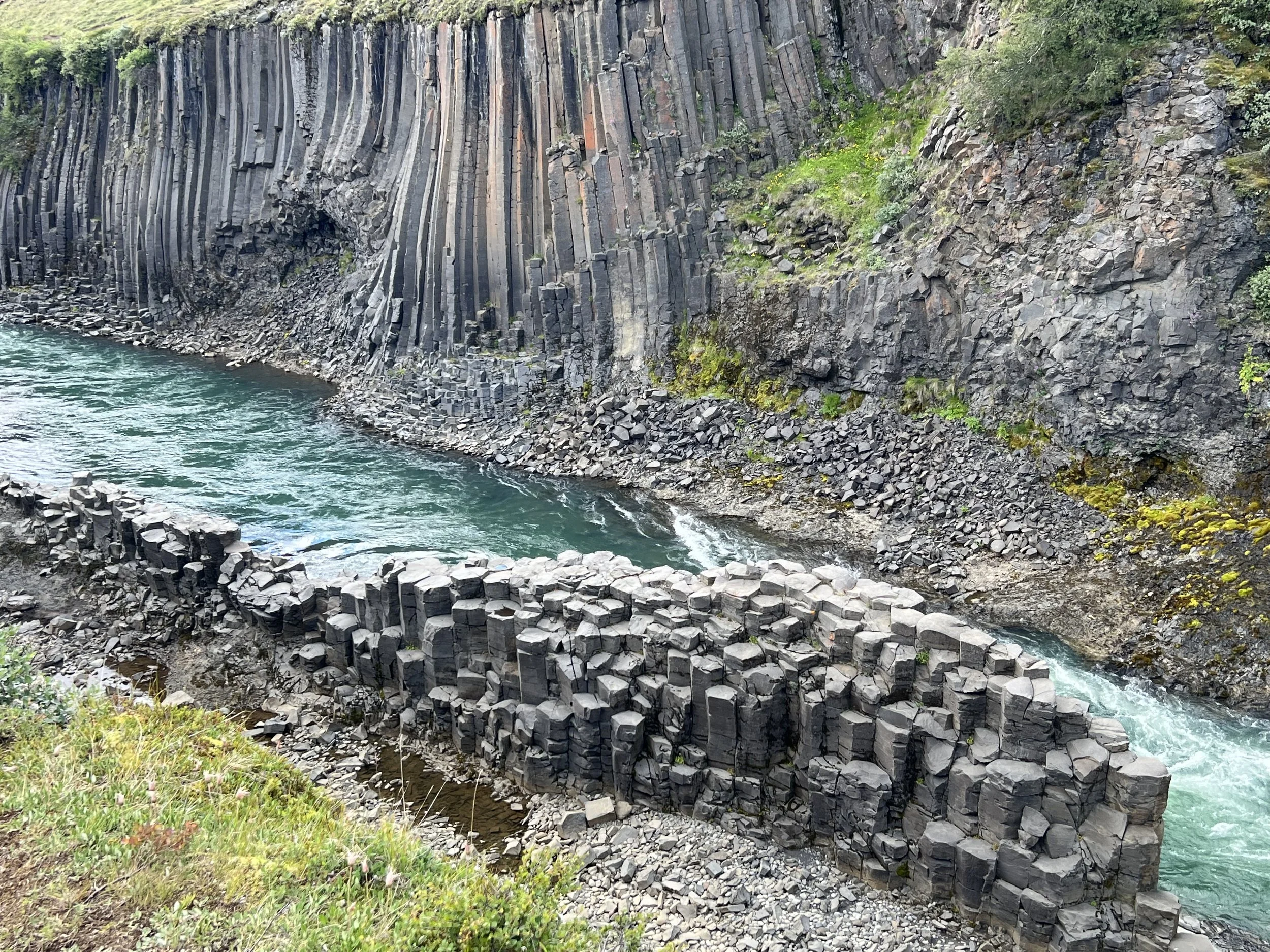
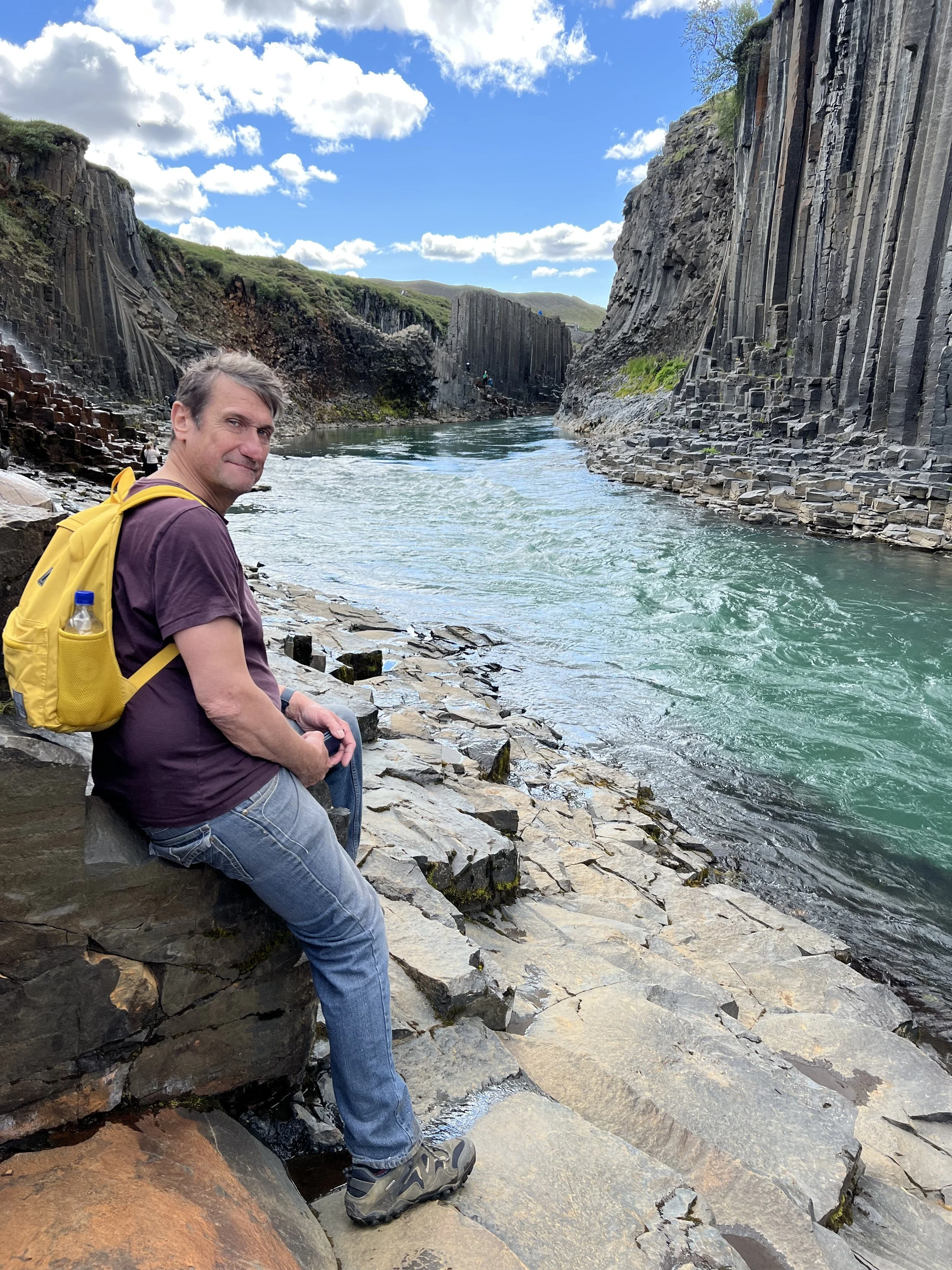
A bit further on, we could see a point where the river forked, and then met again, leaving a tall and narrow island of rock in the middle. It looked possible to cross over onto the middle section and I could see that there were small marker posts on the ‘island’ so it was obviously allowed, so I decided to see if I could make my way over to it. There was nobody on there, but I headed off and with a bit of scrambling over rocks, made my way onto the central section of basalt, from where I could look back up the section of canyon we’d walked along, with the viewing point on the other side. It felt like being on top of the world! A definite Instagram shot!
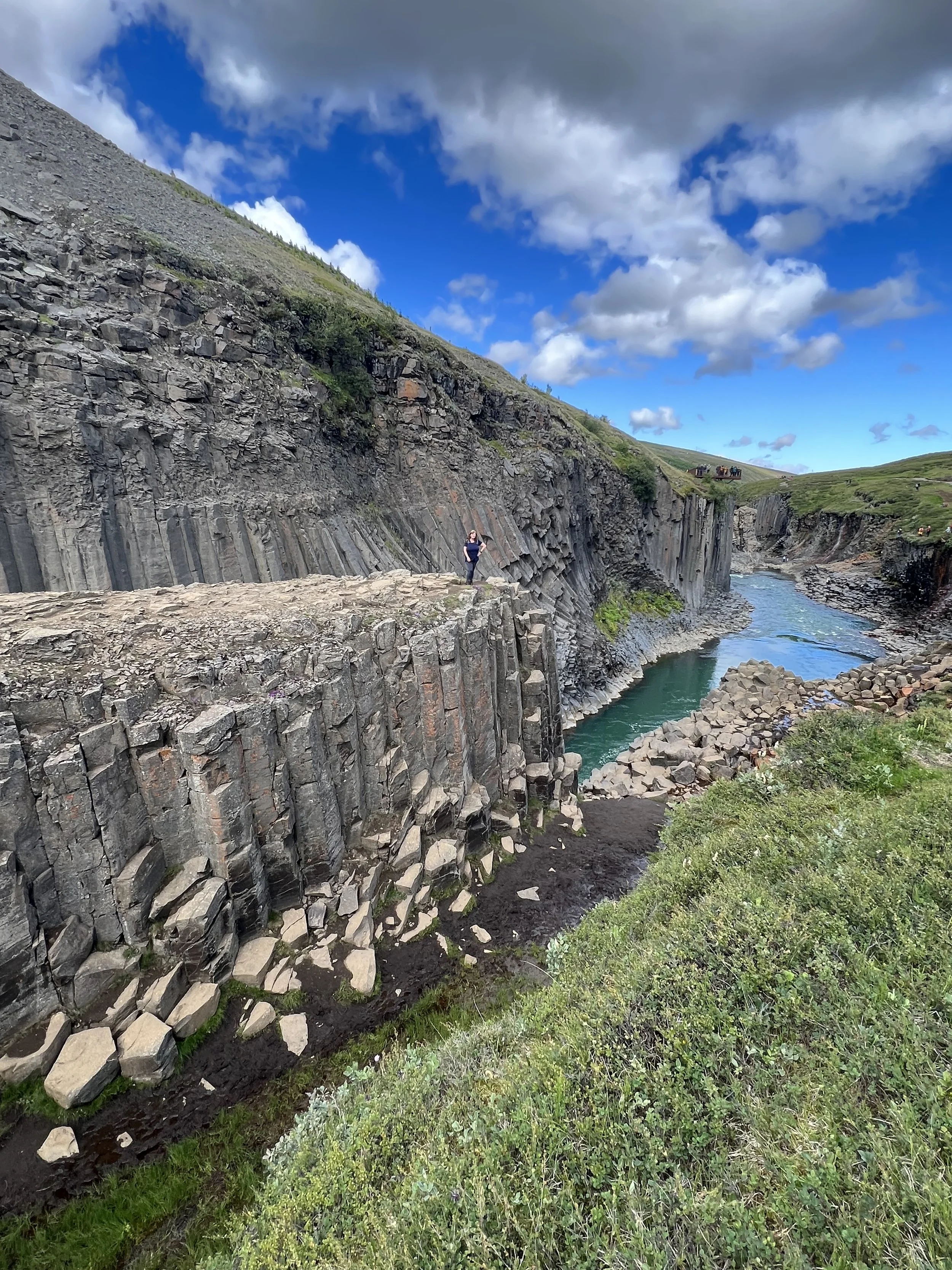
I felt a bit like ‘instagram girl’ for the shot above. Below a few more pics as I made my way to the edge.
A bit further along we decided to clamber down to the river’s edge and were able to sit on the broken basalt rocks near the river itself. The views were staggering and the rock formations incredible. This place is utterly amazing. We did need to be careful as the rocks and stones are very slippery when wet, so we climbed very slowly and carefully, and I was very thankful indeed for my new leather walking boots, which are worth every penny spent on them! If the weather had been very wet, or icy, we would probably not have climbed down to the bottom of the gorge as I would imagine it could be quite dangerous.
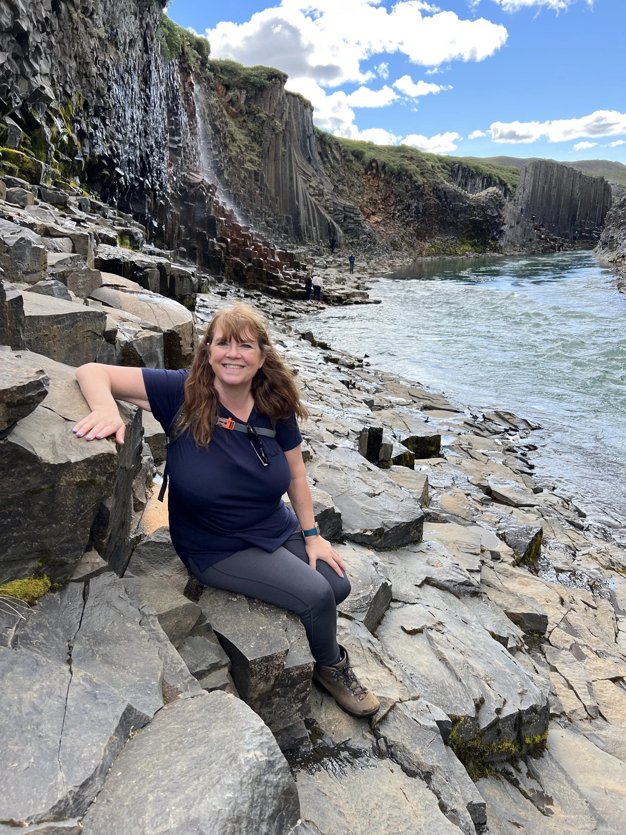
Down by the river itself, having clambered down the rocky slope
Eventually, we came to a bridge which had been roped off to stop people crossing it, so we decided that was as far as we should go, and headed back the way we’d come. The views look slightly different from the opposite perspective so we still found plenty of places where we needed to stop and take pictures.
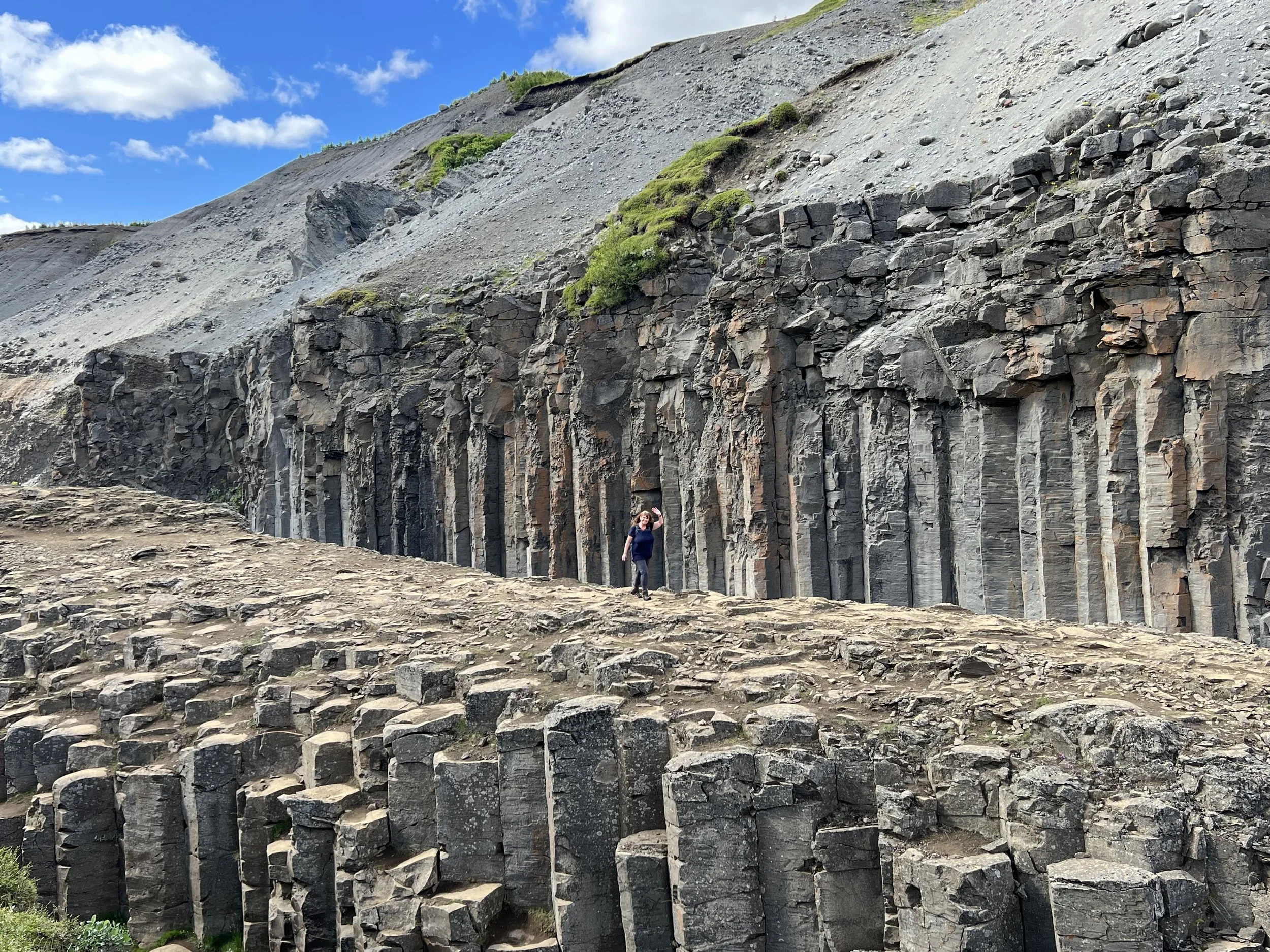
The incredible basalt columns, all packed together, some vertical some horizontal
As in so many other places in Iceland, the paths are well marked with posts, and it is clear where it is safe to walk. There are no fences or railings (other than on the viewing platform on the other side) but people are expected to show common sense and to take care, both of themselves and of the fragile flora and fauna. Apparently between May 1 and June 10, there are numerous pink-footed heather geese that nest in the area, and so it is especially important to stay within the marked hiking trails so as not to disturb the birds.
This shot shows both the growth of shrubs and grasses providing a haven for wildlife, and the fast currents in the water below
All too soon we had made our way back to the parking lot and reluctantly left this amazing canyon. I am so happy to have seen it – definitely worth the visit, this place was like nowhere I have ever been before. Amazing that only a few years ago it didn’t exist – or at least it did, but was hidden underwater. It makes you wonder what other incredible sights there are in this amazing country that haven’t yet been discovered….?
Stuðlagil is a very special place indeed