Hiking the Laugavegur trail
There are many wonderful hiking trails in Iceland. This country is an absolute paradise for walkers and hikers of all ages and abilities. However, there is one hiking trail that must stand out as ‘the’ hike to do when in Iceland. Not only that, but it regularly features in lists of stand-out hiking trails in the world. This is the Laugavegur Hike across the Central Highlands of Iceland. 56km long (35 miles), it can be done any number of ways; either guided or unguided, staying in the mountain huts that can be found at intervals along the trail or carrying a tent and camping.
Some of the mountain huts (at Emstrur) where hikers can stay, with camping also available
I first found out about the hike when our boss decided to try it out just a few weeks after I had first arrived in Iceland. At that time I figured it was way too challenging a hike for us to consider (at our age and level of fitness) but it always niggled at me as something I would like to do at some point. When another colleague booked it at the start of this year, I decided to just go for it and book. It was quite a shock to realise just how booked up the guided hikes can get; we booked on the 10th January 2023 and the first available trip was from 21st – 25th August. I was a little worried that the weather would be on the turn by late August, and that we could get a lot of wind and rain, but then Iceland’s weather is so unpredictable anyway that there was little point in worrying too much. And, given that the alternative was not to go until 2024, we just decided to take a chance and book it.
We decided to go for the option of a five-day guided hike, staying at the mountain huts each night. I booked for me and Matthew and also Joseph, who wanted to come over to Iceland for the hike. Joseph decided to bring his one-man tent with him and to camp outside so as to get the full hiking experience; we were quite happy to take our place in the mountain huts.

Despite being a challenging hike, it is well marked with signposts to indicate the distance between stopping points
All too quickly the time came round – of course with us not having done nearly as much preparation and fitness training as we had intended to!!
I was somewhat worried about my ability to complete the hike as I had been unwell for the few weeks prior to the trip; suffering since mid-July from an undiagnosed tummy bug, and then contracting a nasty throat infection only 10 days or so before our departure date. Even up to the night before, I was still undecided as to whether or not I should go, but thanks to some super strong antibiotics I made the decision to go for it.
The trip was Monday – Friday with the Laugavegur hike itself taking four days and the final day spent in and around Þórsmörk.
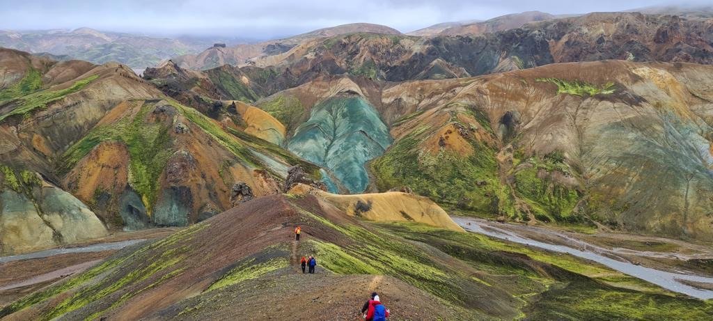
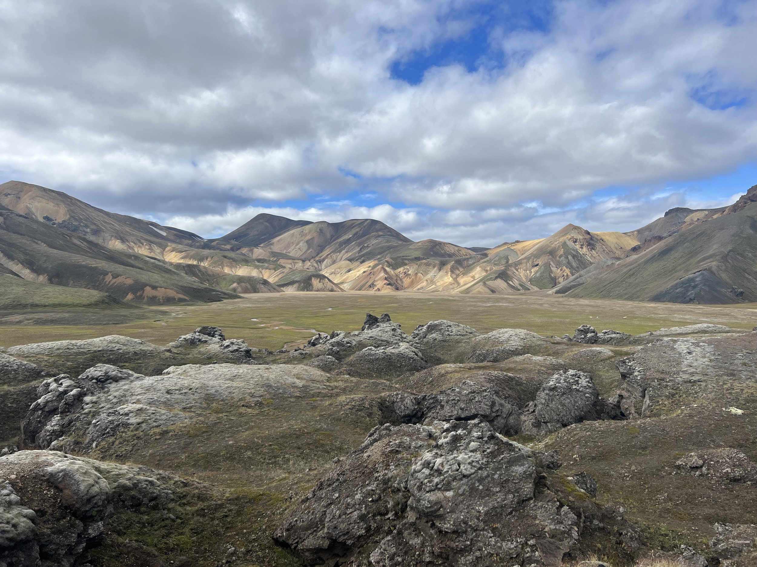
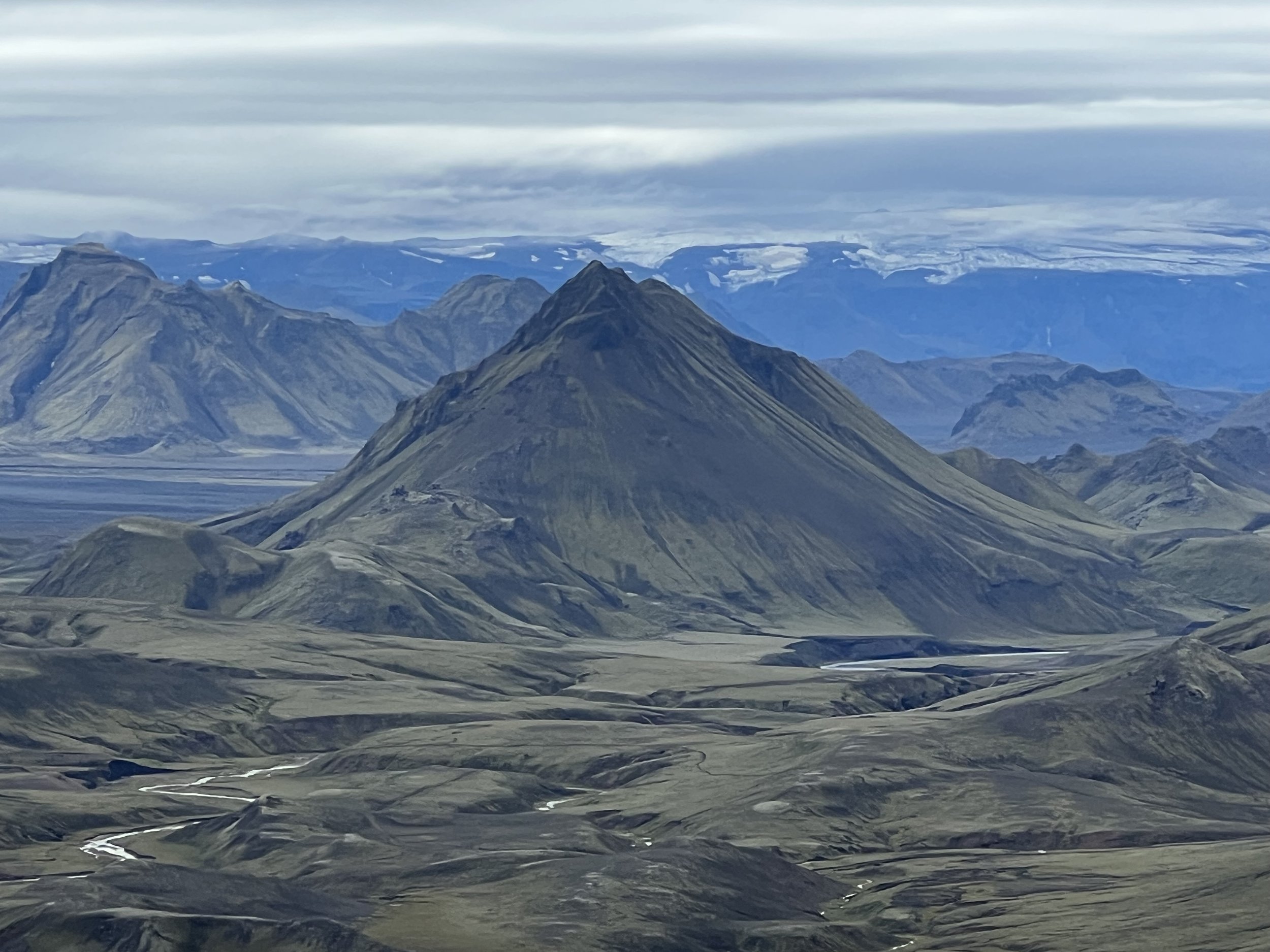
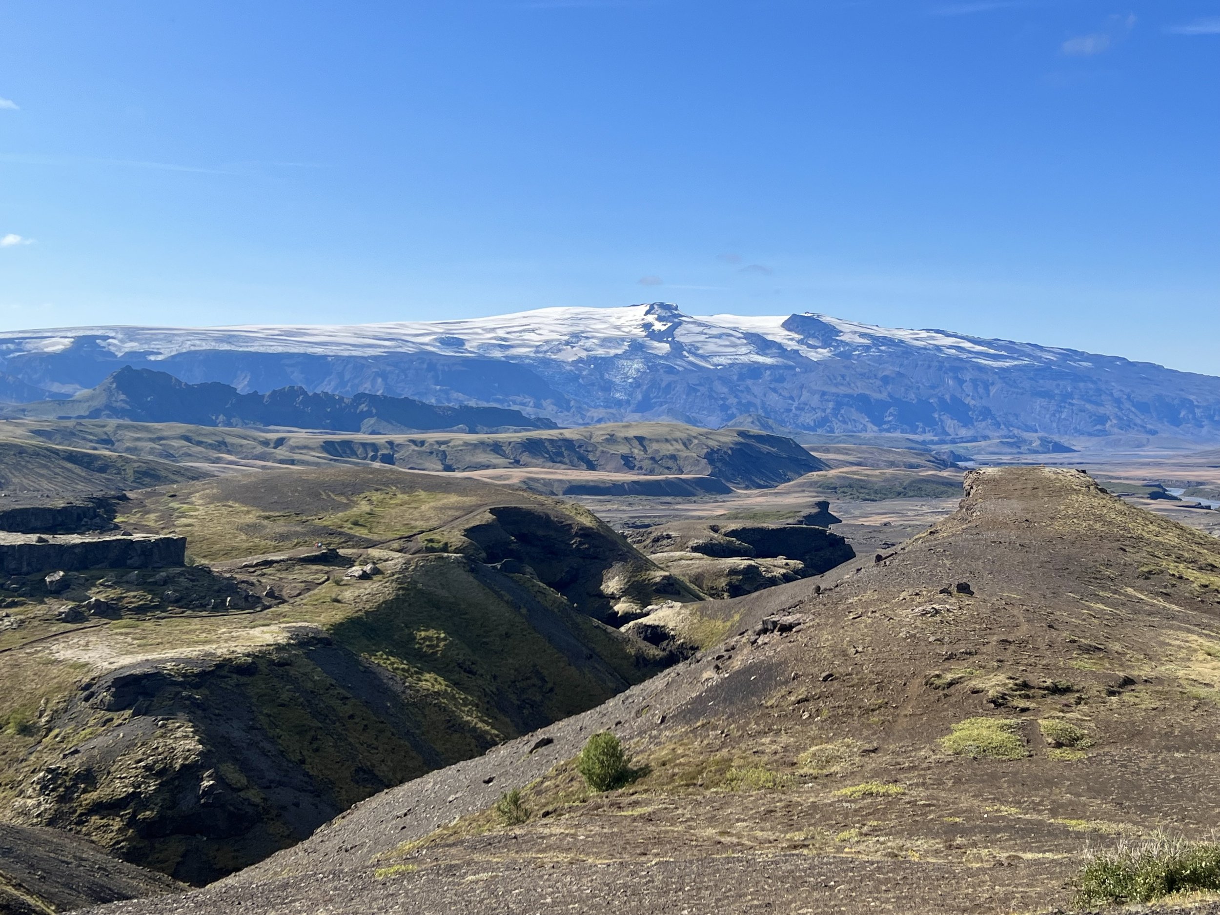
One of my favourite pictures of the central highlands…. This is why we do this hike - to see parts of Iceland that are only accessible on foot
Day 1: Reykjavík - Landmannalaugar - Hrafntinnusker
We met up bright and early at 6.30am on the Monday morning at the BSÍ bus station in the centre of Reykjavík, with all our bags and rucksacks. Because we were on a guided hike we had the luxury of being able to take just what we needed for each day in our backpacks, as the rest of our gear was taken for us from hut to hut by a driver with an all-terrain transport vehicle.
Once we had been met by our guide Ingibjörg (Inga) and our names checked off the list, we were able to get onto the coach which was to take us to Landmannalaugar, where the trail begins.

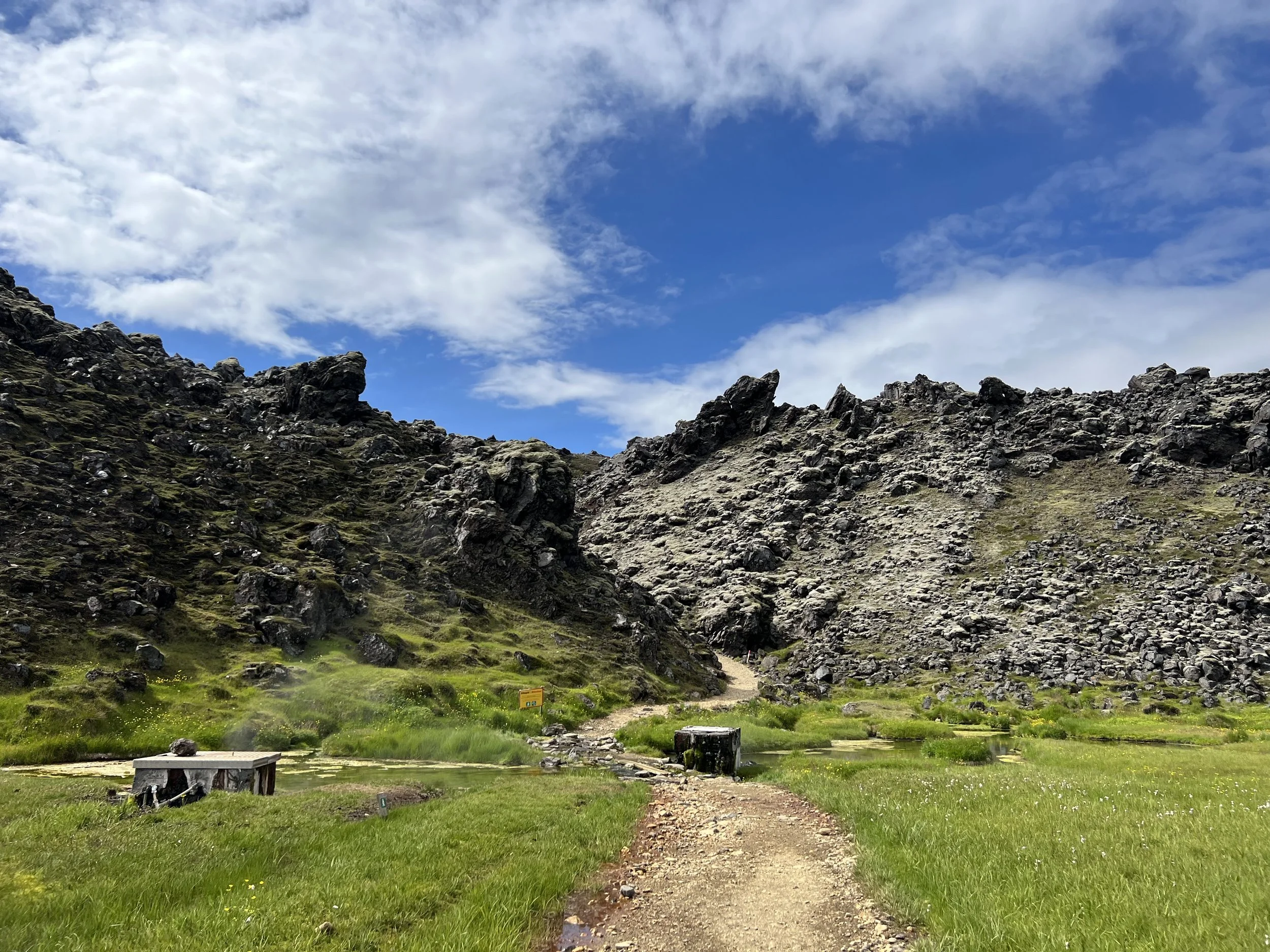
The huts and camping ground at Landmannalaugar, the start of the trail
The coach journey was long, as it made its way down the south coast, then branching off into the highlands, most of which was along gravel roads, so it did seem to take forever. However, it was actually only about 4 hours, and it was interesting watching how the landscape around us changed the further into the highlands we drove.
Eventually we reached Landmannalaugar where we gathered in one of the large tents for lunch, after which we had an hour or so to take a dip in Landmannalaugar´s hot river geothermal spring. This was Joseph´s first taste of geothermal bathing.


At the designated time we all gathered for a pre-hike group photograph and then set off.
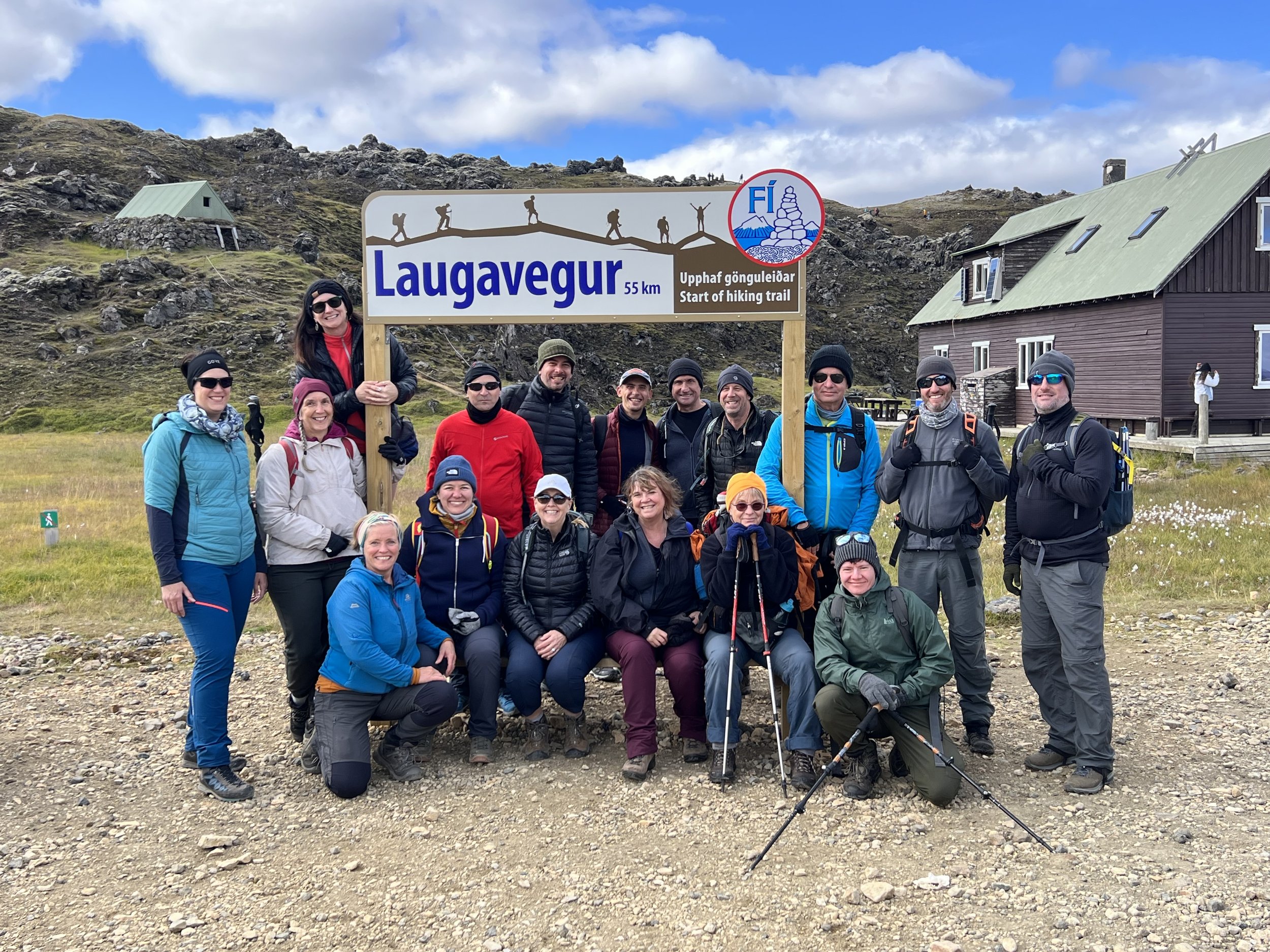
A group photo before we set off….
The very beginning of the hike as we leave the camp site at Landmannalaugar
We started our day’s hike by crossing the 500-year-old Laugahraun lava flow that is still heating the Landmannalaugar hot springs. The entire day´s hike was, in effect, a continuous climb with a few breaks in the steady uphill ascent. We crossed a succession of rolling rhyolite hills – absolutely staggered by the beautiful views - the flora and the mountains which seem to feature all the colors of the rainbow. I´ve never seen anything like it.
Some of the beautiful views at the start of the hike


Although on this first day we walked past numerous sulphur vents, a little way into the walk we descended to the steaming hot springs of Stórihver, with steam rising all over the place in plumes from cracks and vents in the earth. Every now and then we´d come across a little pool bubbling and hissing away. The group was warned to keep well back and not to try to touch the water or even walk over wet areas as it is so dangerously hot. This first day had the highest elevation and it seemed that we were going uphill pretty much the whole time, although the ascent was relatively gentle.

Rhyolite mountains
The scenery changed significantly as we walked; the colourful, undulating hills were replaced with stark black volcanic slopes. The higher peaks are striated with snow all year round; and we could feel that the temperature had dropped significantly as we made our way over a hillside that was nothing but snow and ice as far as we could see.


The last part of the day´s trek was climbing Hrafntinnusker mountain. This mountain As we got close to the mountain hut Hrafntinnusker slope of Söðull, you’ll find a sobering memorial to a former trekker.
“In loving memory of Ido Keinan, who passed away in a blizzard so close to the safe hut nearby yet so far at only 25 years old,” reads a metal plaque drilled into a basalt cairn.


We continued climbing up the bare obsidian mountainside until we reached the Hrafntinnusker hut, towards the end of the afternoon. Located at an elevation of 1110m, it’s the highest point on the trail, surrounded by snow and dark mountains streaked with ice. Boy was I glad to get there! The huts that we were staying in were surprisingly large and were heated with hot and cold water (which sometimes had to be pumped using a nifty kind of metal footpump beside the sink) so were a nice surprise. The toilet block, however, wasn´t! It was outside, a little way from the main hut and as we approached it we realised why…. We reached the smell long before we reached the door to the block and discovered that the loos at this particular mountain hut are pig latrines that I´m assuming don´t get emptied until the end of the season, judging from the stench!!
As we were bagging a sleeping spot on the wooden bunkbeds that ran the length of the room (everyone slept side by side in their sleeping bags), Joseph wandered off to find a place to pitch his little one-man tent. I looked out of the window a few moments later, and was more than a little surprised to see it was snowing!! In August. I went out to find out if Joseph wanted to bunk down in the hut instead but he was undeterred and quite happily set up his tent in the snow – bonkers boy!


Meals were cooked by our guide Inga, along with volunteers from the group – we all put ourselves forward to cook and clear up at least once, which worked well and meant that for most of the trip we were catered for. The food turned out to be remarkably good, generally big pot meals which were filling, hot and tasty.
There were so many highlights of the day; the beauty of the rhyolite mountains near Landmannalaugar, checking out the Stórihver hot springs, crossing an ice-covered hillside and having to use our walking poles so as not to slip and of course the obsidian mountain. I have never had a day like this in my life – just incredible.
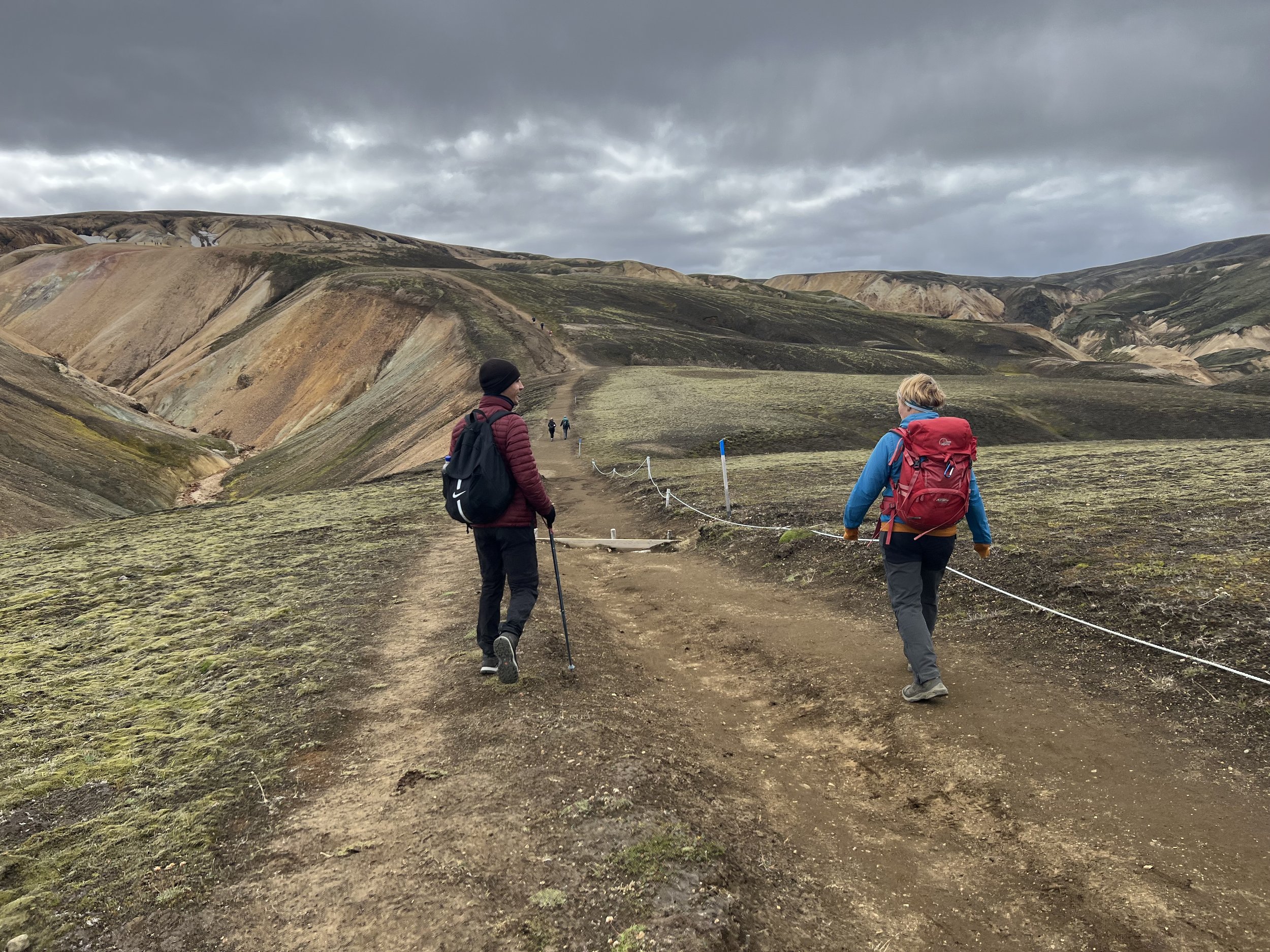
Joseph and Inga chatting as they walk
Stats for day 1
o Distance:12km (7.5miles)
o Active walking time: 4-5 hours Ascent: 470m (1540')
Day 2: Hrafntinnusker - Álftavatn (Swan Lake) - Hvanngil
Today we headed south into the canyon complex to the south of Hrafntinnusker. Descending into the gorges of Jökultungur, we came across more steaming hot springs and mud pools. The route wound southwards, crossing snow and ice patches and climbing ridges where we had amazing views across the dark volcanic plains towards lake Álftavatn and the Mýrdalsjökull and Eyjafjallajökull glaciers. As it was so cold, we had wrapped up warmly with lots of layers and for the first part of today’s walk we needed it.


Crossing the southern edge of the Torfajökull Massif, we stopped a few times. We soon needed to strip off some of our layers as once we got away from the high point of Hrafntinnusker the sleety rain stopped and we got very warm very quickly, particularly as there were a number of quite tough ascents, despite the fact that we were on a roughly downhill trajectory.
I don’t think I had realised just how many mountains we had to scale just to get from A to B. Whenever we asked Inga about what the day’s walk would be like (regardless of the day) her response would be a breezy “Oh, we have a few ups, and a few downs…… then maybe a few more ups and a few more downs!”. After one of the longer ‘ups’ we stopped for our picnic lunch with the most incredible views in every direction.


It is hard to pick out any one particular view, as the vistas were amazing wherever we looked, but I was particularly taken with the lovely conical peak of Stórasúla, which is a perfect pointy triangle - just how everyone imagines a volcano should be.

A river bed of fluorescent moss leading to the peak of Stórasúla
After our lunch and a much needed cup of tea, we set off on the long, long, long descent towards Lake Álftavatn (Swan Lake). Oh my word, some of the climbs are hard work, but that descent was exceedingly tough on the knees!!

Halfway down the steep descent towards Álftavatn
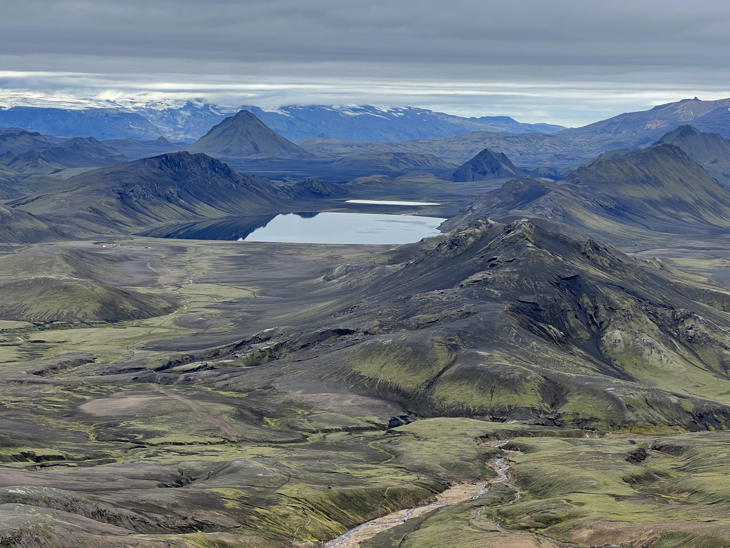
Lake Álftavatn
Arriving at the lake, one of the most beautiful locations on our route, we realised that we had made such good time that Inga explained that this was where we had been supposed to spend the night, but suggested that we walk a little further to the Hvanngil mountain hut, rather than staying at Álftavatn, so cutting a little off the next day´s hike. However, we did stop for an hour or so at the Álftavatn mountain hut where there was a bar – which was a very welcome surprise, as even though some of the mountain huts sell drinks and snacks, they don´t sell alcohol.

The welcome sight of the Álftavatn huts below us
So we had a very welcome break sitting outside the bar at Álftavatn with a glass of wine or beer in the warm sunshine, with the view of the lake before us. It all felt most civilized. We did have some entertainment when one of our group dropped her phone and it fell between the slats of the decking that was all round the bar hut. We figured she´d lost it for good but Joseph saved the day by finding an access point under the decking and shimmying on his belly along the tiny crawl space to where the phone was. He was definitely the hero of the moment for that feat, which only someone as fit and lithe as him could have managed.


After our break, we set off again (which was tough) and did the last 4km or so, descending to the green oasis of Hvanngil in time for a good rest before dinner. Although there were 16 in our group, the huts sleep some 40-odd people, so we met other people in the evenings and exchanged greetings and stories.


My highlight of the day has to have been the stunning view of Álftavatn as we descended the long mountain slope towards the lake.


o Distance: 16km (10 miles)
o Active walking time: 5-6 hours Descent: 490 m (1610 ')
Day 3: Hvanngil - Emstrur
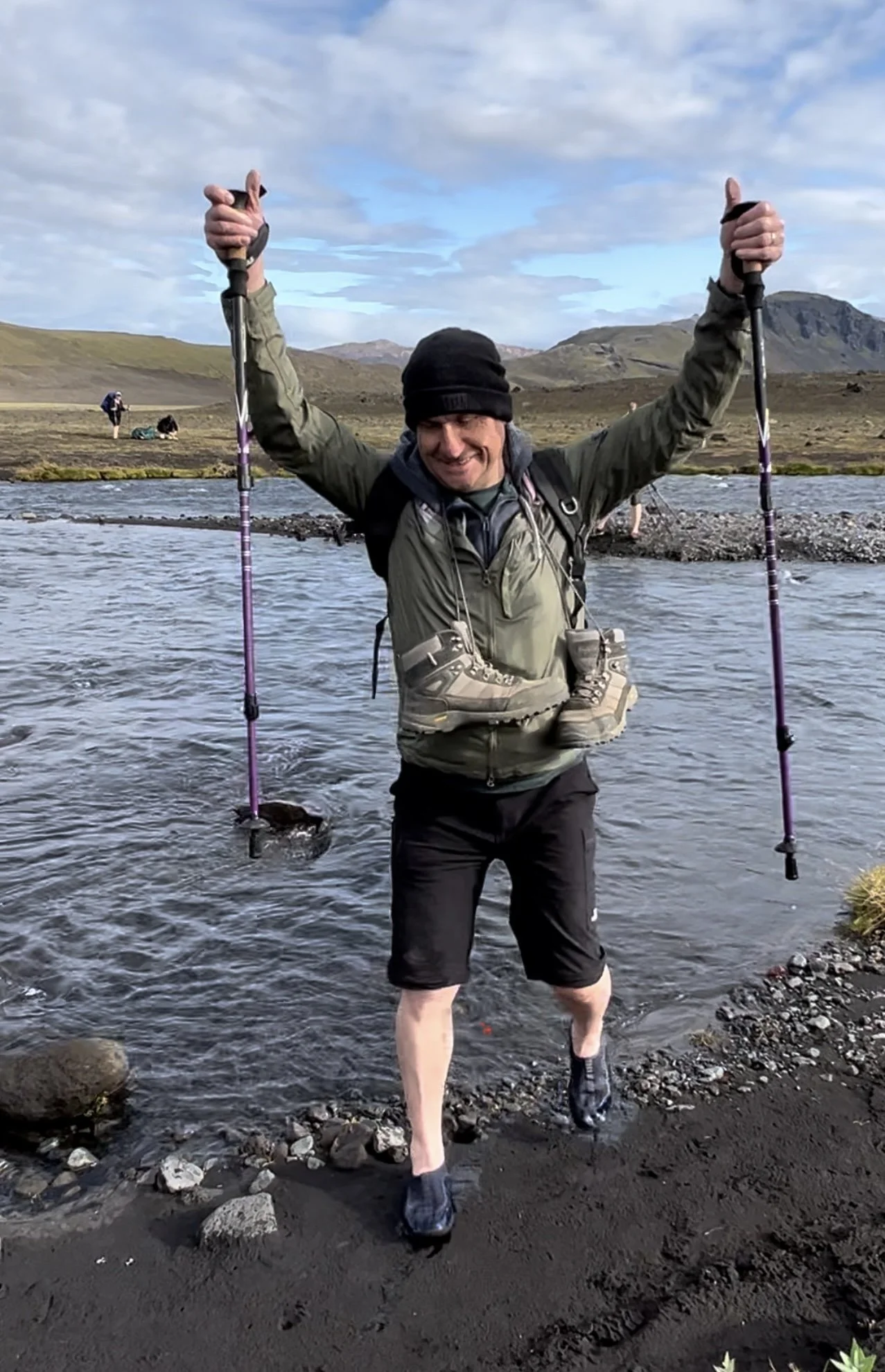
On day three we had several rivers to cross, as we headed southwards and towards the Mýrdalsjökull icecap. Some of the glacial streams and rivers have bridges, but others need to be crossed on foot – which can be a very chilly experience for the feet although river shoes definitely helped.


The start of today’s hike was relatively easy, mainly downhill or on the flat, and Inga kept us entertained with many stories and historical details about the area.


After the river crossings we came to the surreal 5-kilometer-wide, black sand plain of Mælifellssandur. This black desert is quite unlike anywhere else we´ve seen in Iceland.

I was warned about day three and told to be prepared for it to be really boring, but actually we didn´t find it boring at all. Partly this was because this day was the flattest terrain, with relatively few mountains to cross, although the going was quite tiring walking over sand for much of the day. But, barren as the desert itself was, we were treated to 360° views all around us of the mountains - including the lonely mountain of Mælifell which sits in the middle of the black sand desert, green with moss against the dark flat desert surrounding it.

Looking across the desert towards Mælifell
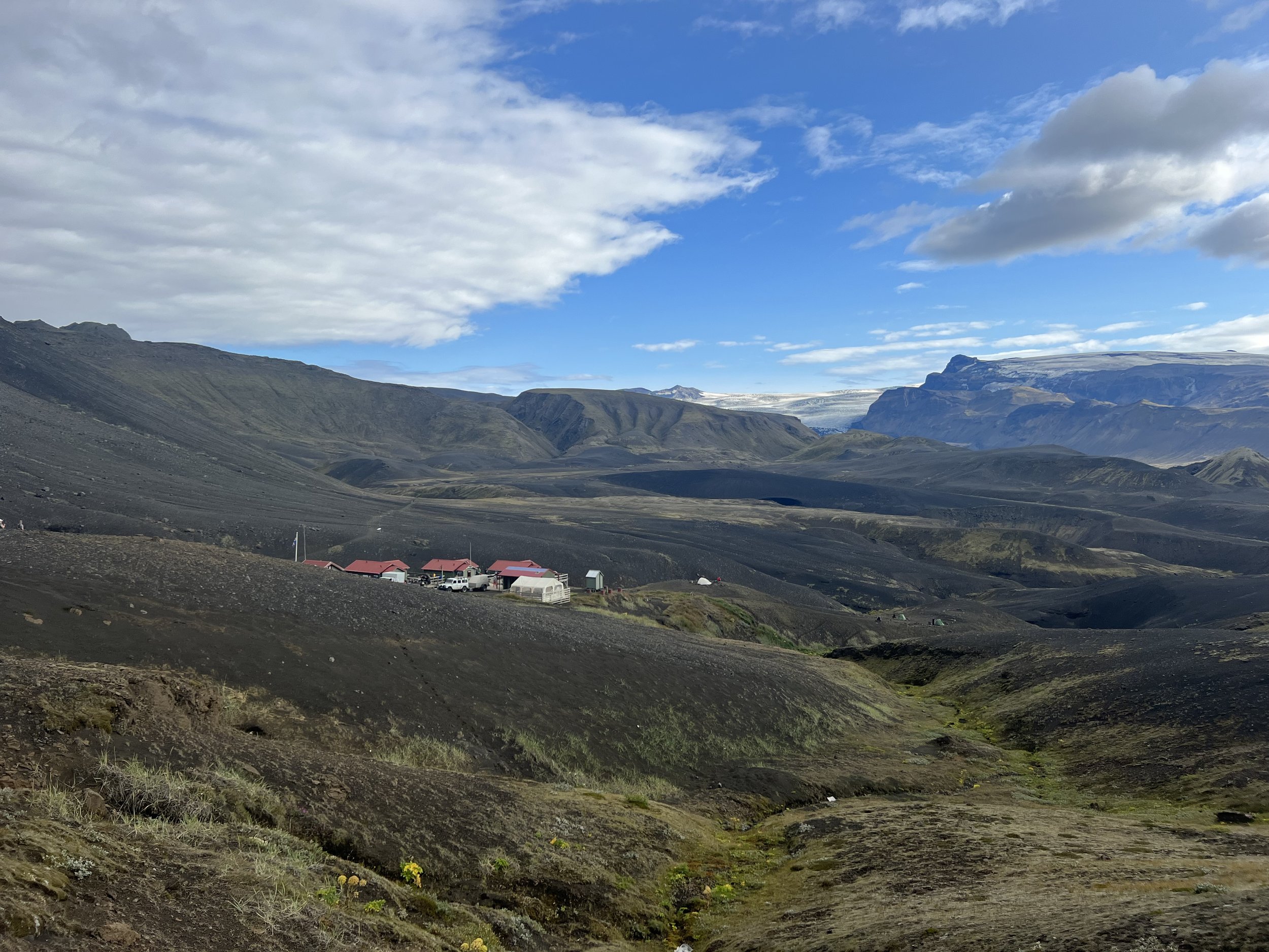
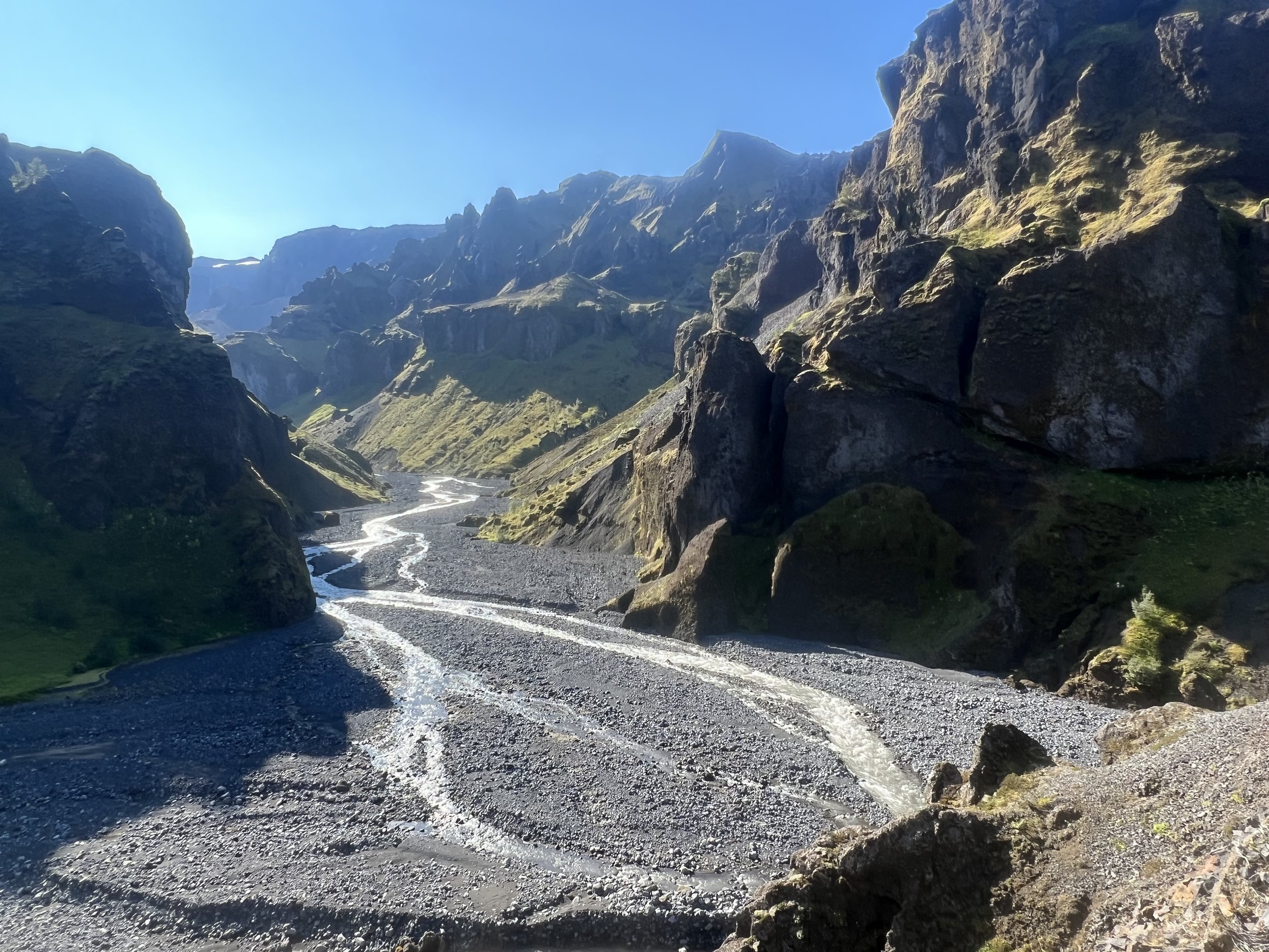
Once we´d crossed the desert we climbed quite a way, thus giving us lovely views again, and stopped for a late picnic lunch. Heading towards Hattfell, another ancient volcano, we reached the Emstrur region where farmers used to graze their sheep in summer. Before arriving at the Botnar Mountain Hut (our accommodation for the night) Inga gave us the option of just going straight to the hut, or doing a detour to visit the magnificent Markarfljót canyon, which is some 200 meters deep and was carved out by thundering floods, caused by volcanic eruptions under the ice cap. Although some people did choose to go and rest up at the hut, we (and most of the group) opted to do the Markarfljót detour, thus adding another 5km or so to what would have been our shortest day. What a great decision that was!
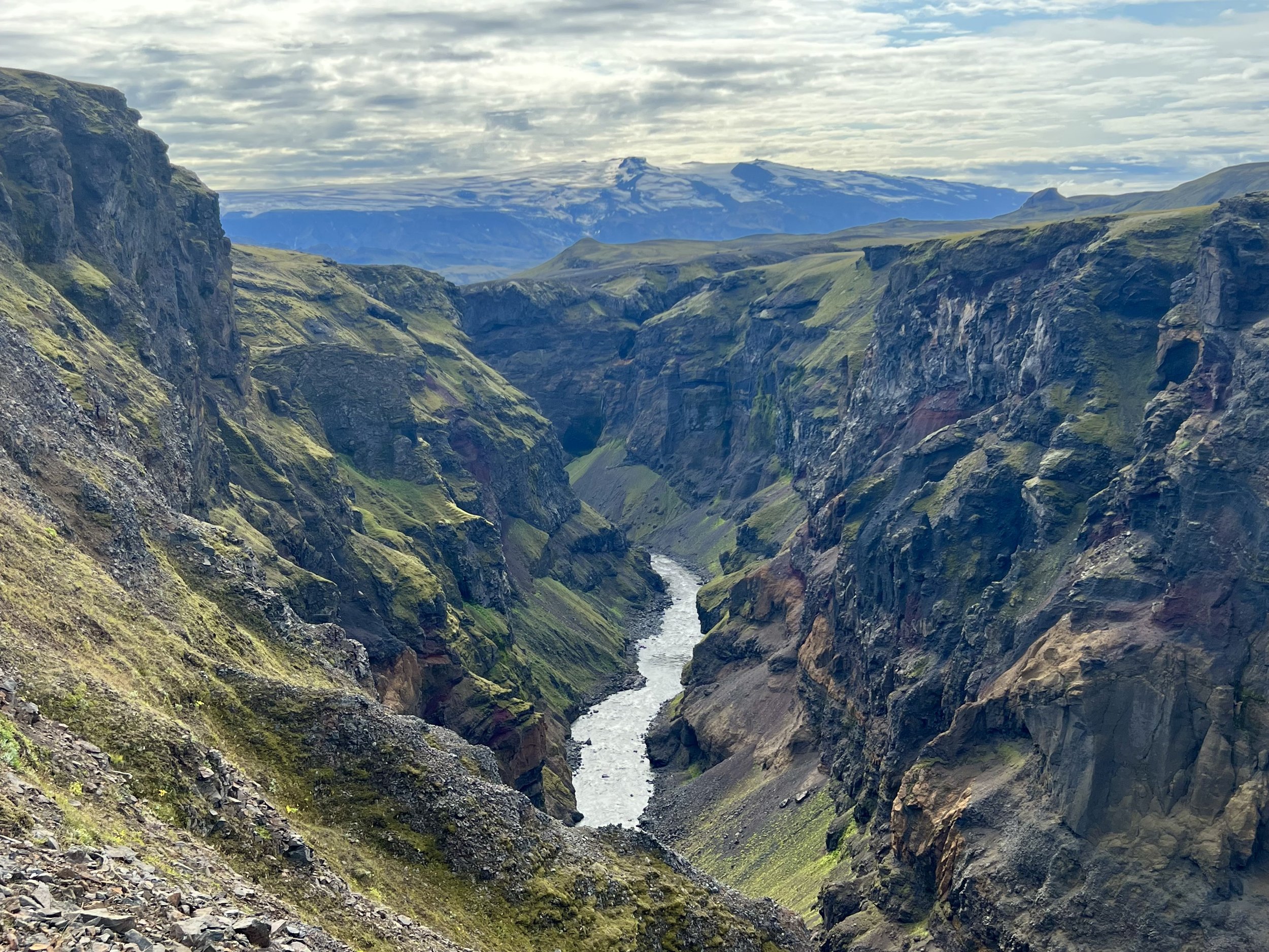
The stunning Markarfljót canyon
The canyon is absolutely stunning and I would have been very disappointed to have missed it. We did a big loop, stopping at various points to get photographs near the edge of the canyon, causing more than a few of the group a touch of vertigo in places. After our detour round the canyon, we looped back again and returned to the Botnar hut for dinner.


Highlight of the day - definitely Markarfljót canyon. Just stunning.
o Distance: 17km (10.5 miles)
o Active walking time: 6-7 hours Descent: 40 m (130 ')
Day 4: Emstrur – Þórsmörk valley
The first part of the day´s walk was a steep descent from the hut to cross the bridge across Emstrur River. We then trekked through the end of the Markarfljót Canyon, getting different views but none as stunning as the evening before, when we hiked along the top of the canyon.


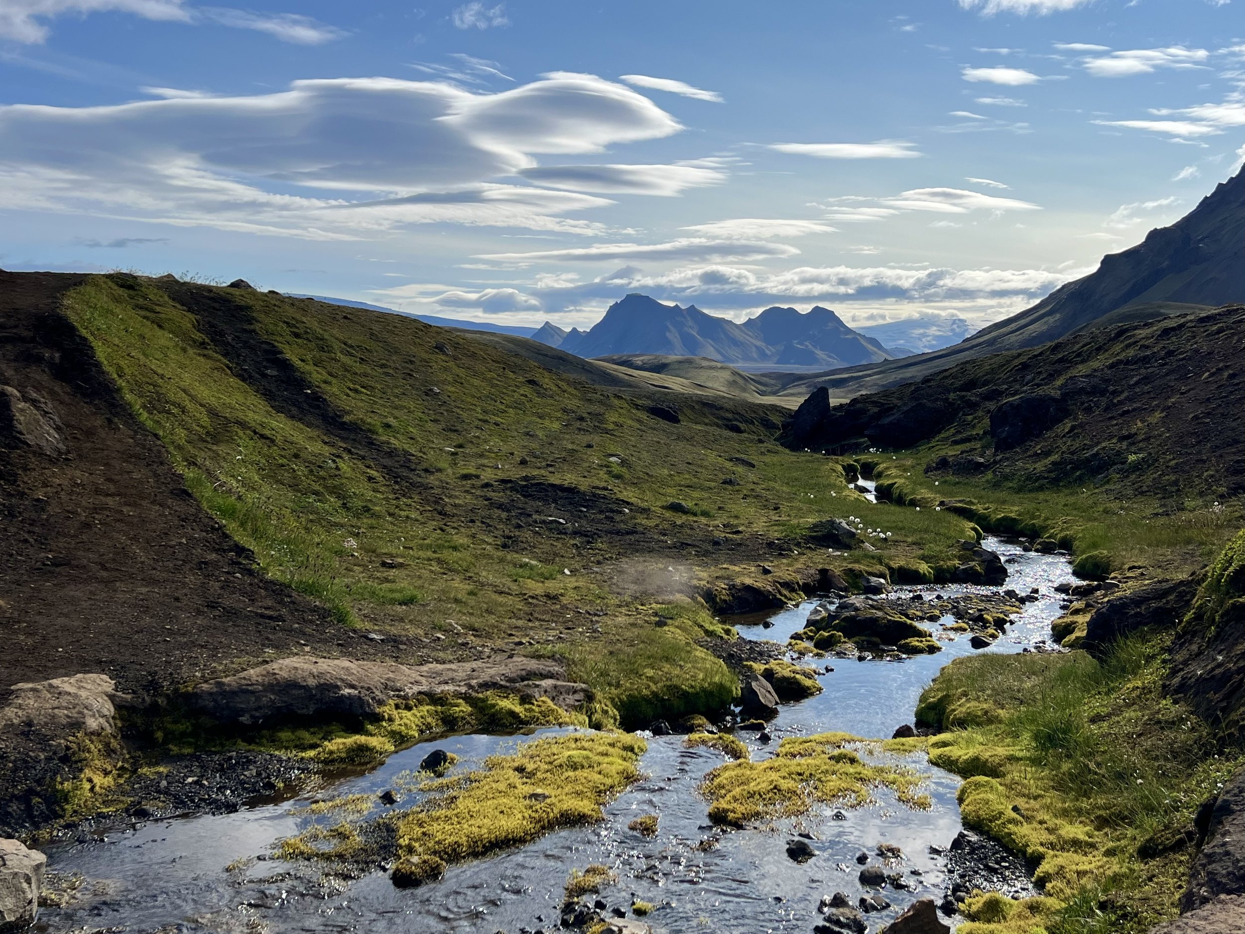
As we walked, on what turned out to be the hottest day of the trek, we could see that gradually the amount of vegetation increased as we walked. First we could see a few scrubby bushes, then noticing little flowers and plants dotted around and gradually the vista became greener and greener until we got to Þórsmörk Valley.
As we approach the valley of Þórsmörk, looking across to the glacier of Eyafjallajökull
For the first time on our trek, we entered a green and well-vegetated valley, which became more and more luxuriant the closer we got to Þórsmörk. The last part of the hike was through thick birch forest, where even the lava ridges were covered with scrubby trees and the lovely arctic flowers that bloom for a few weeks each summer. Þórsmörk means Thor´s forest and it is easy to see why this area is considered to belong to a Norse God. It is just out of this world!


The valley is guarded on all sides by fast-flowing rivers and steep glacier-clad mountains. It is one of the most beautiful spots in Iceland and a favorite weekend retreat for many hikers. The weather got warmer and warmer as we walked and Inga was very anxious to make sure we all refilled our bottles at every safe opportunity to do so.

Never has cold water felt so good!
By the time we got to the final river crossing, which was a much wider one than usual, we were so hot that Joseph ended up just dunking his head in the water to cool down! I satisfied myself with repeatedly scooping up water in my cap and putting it on my head, letting the water pour over my head and down my shoulders. Utter bliss!
As we got to the end of the trail we were exceptionally happy to find that the end was at one of the Þórsmörk huts – again with a bar!! I think everyone in the group started walking more and more quickly the nearer we got to this nirvana! It was still really hot so we sat in the shade by the bar and exchanged thoughts about our favourite parts of the hike whilst drinking a well-deserved cold drink. I tell you, a mini bottle of prosecco has never ever tasted so good!

We did it!! A very proud and happy group.
After our drinks and an end-of-hike group photo, we made our way across and along the other side of the river to the Básar huts where we were staying, where there were far more facilities than in any of the huts we´d stayed in on our way here – including a bar, a cafe and a shop!
To add to the sense of excitement, there was a group of people there who turned out to be a wedding party, preparing the Þórsmörk area for a wedding the next day.


Joseph had his easiest tent set-up here, on green grass in a sheltered spot and a very happy and relaxed evening was had as we had a special barbecue dinner with a real air of celebration about it. We did it! 56km up and down mountains, over desert, over glacier ice, through hot springs and fumeroles, past rhyolite mountains, over a mountain made of obsidian, discovering caves and waterfalls, rivers and gorges. What a feat!

Back in civilization at last!
There were several highlights from this day; cooling down in the river, enjoying the lush greenery, taking the end-of-hike pictures and knowing we had actually done it!!
o Distance: 17km (10.5 miles)
o Active walking time: 6-7 hours. Descent: 300 m (985 ')
Day 5: Þórsmörk - Reykjavík
We spent the morning in Þórsmörk, and were given the option to take it easy and rest or to walk one of the many trails in the area. Of course we chose the latter! Why oh why did I assume that today´s hike would be a nice gentle ´reward hike´? As we clambered up the steep hillside up to the viewpoint of Valahnjúkur, from where we could see over the two glaciers Mýrdalsjökull (1460m) and Eyjafjallajökull (1666m), I very very nearly turned back and gave up on the day´s ´gentle´ reward hike, and may well have done so had the other group´s guide not stopped and encouraged me to carry on… so inwardly cursing her, I continued and gradually got my second wind.
The hike was by no means an easy one though, even once the long ascent had been conquered, as from there we had to descend again, down incredibly narrow sheep trails that were made of nothing but scree and which we slipped, slithered and scrambled down, before getting to the next climb. Having said that, the views were beautiful and it was good to see some more of Þórsmörk than the gentle lower slopes of birch forest and grass. By the end of this day´s hike, we really did feel a sense of achievement, and that we´d finished the trek in good style. Again, the weather was incredibly hot and we filled up our water bottles at every opportunity. Several of the group did catch too much sun, feeling unwell on the journey back. I would never have believed it possible to get sunstroke in Iceland…. who knew!??

After lunch back at the Þórsmörk hut, we gathered all our belongings and stuffed them into the bus which had come to take us back to BSI bus Station in Reykjavik. Even this last journey was not without its hiccoughs as our coach wasn´t able to navigate them any river crossings, so we were put on a big wheeled bus that took us through the many streams and rivers that meander over the route back to civilization and normal roads, but then it had to return to Þórsmörk to get the next group, so disgorged us and our belongings by the side of the gravel road and told us to wait until the normal tour bus arrived. After not too long a wait it did get there and we set off, again, for our trip home.

The view as we descended towards the Básar huts, looking down to the finishing point of the Laugavegur trail on the other side of the river.
We finally arrived back in Reykjavík at around 19:30 and found a bus to take us home to the apartment, where hot baths and a slap up meal awaited. So, although the actual distance of the hike was 56km, over the five days, we ended up walking some 70km (44 miles), given our added detour on day 3 and also the optional hike on day 5. Which was pretty good for a couple of old codgers who didn´t do nearly enough training beforehand! Joseph of course probably covered half as much again, as he would regularly trot from the front to the back of the group, chatting away to people, and climbing random mountains during lunch stops, just for the fun of it! As a regular hiker, The entire trip was absolutely amazing and I would recommend it to anyone who enjoys walking. We saw parts of Iceland that most people probably never get to see, and had the most incredible time. The trip wasn´t cheap, and at times it was challenging (I do remember getting to the foot of yet another steep mountain, looking up at the ascent and saying “no, no…. just leave me here, it´s fine“) but I am so very glad I´ve done it and will treasure the memories for many years to come.

Beautiful Þórsmörk
I´m tempted to say that soaking in a bath was the highlight of the day, but I think it was really just the overwhelming sense of achievement, having completed such an iconic trek, particularly as I had been so close to deciding not to make the trip the Sunday before. Of all the adventures we have had in Iceland, I think this has to be the best and greatest adventure.
o Distance: around 8km (5 miles)
o Active walking time: 3 hrs.

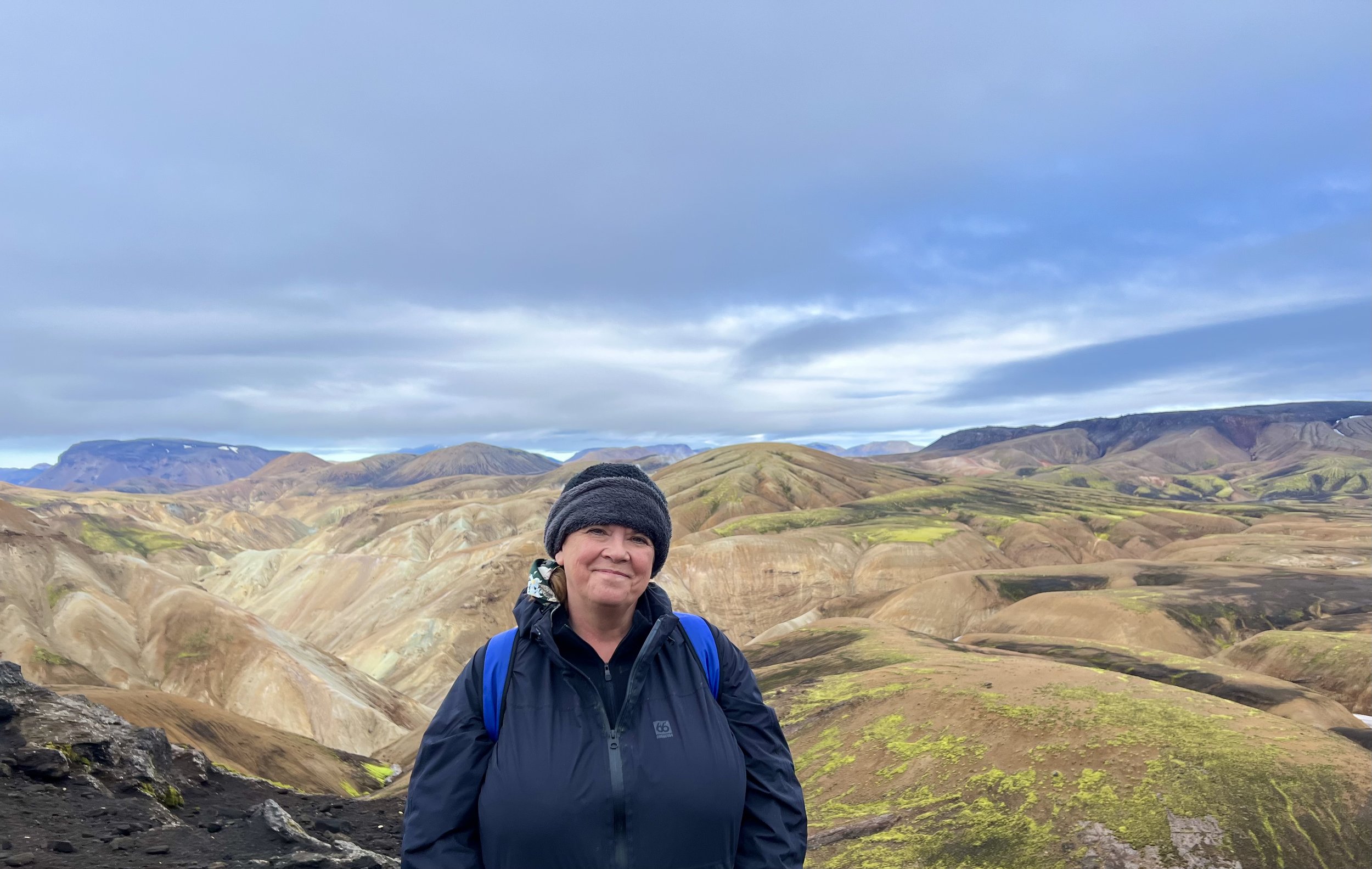
Photo taken towards the end of the final hike
